Login

Forgotten password?

Cookies have to be accepted!
Your browser's cookie functionality is disabled. Please enable this functionality.

Not a member yet?

Register now
Login

Available for registred users only

Log in to use this feature.

Forgotten password?

Cookies have to be accepted!
Your browser's cookie functionality is disabled. Please enable this functionality.

Not a member yet?

Register now
Filter
Categories
Advanced filters
  • Distance (km)
  • Height
Save filters Reset filter

TrackRank

QRCode

Technical data

Distance5,1 km Height142 m Way down142 m Duration01:00 h:m Date09.11.2008
Scores Author Landscape Fun factor Fitness Technique

Statistics

2029 Views Scores 53 Downloads Average
Rate
  • Track data sheet
  • Directions
  • Downloads
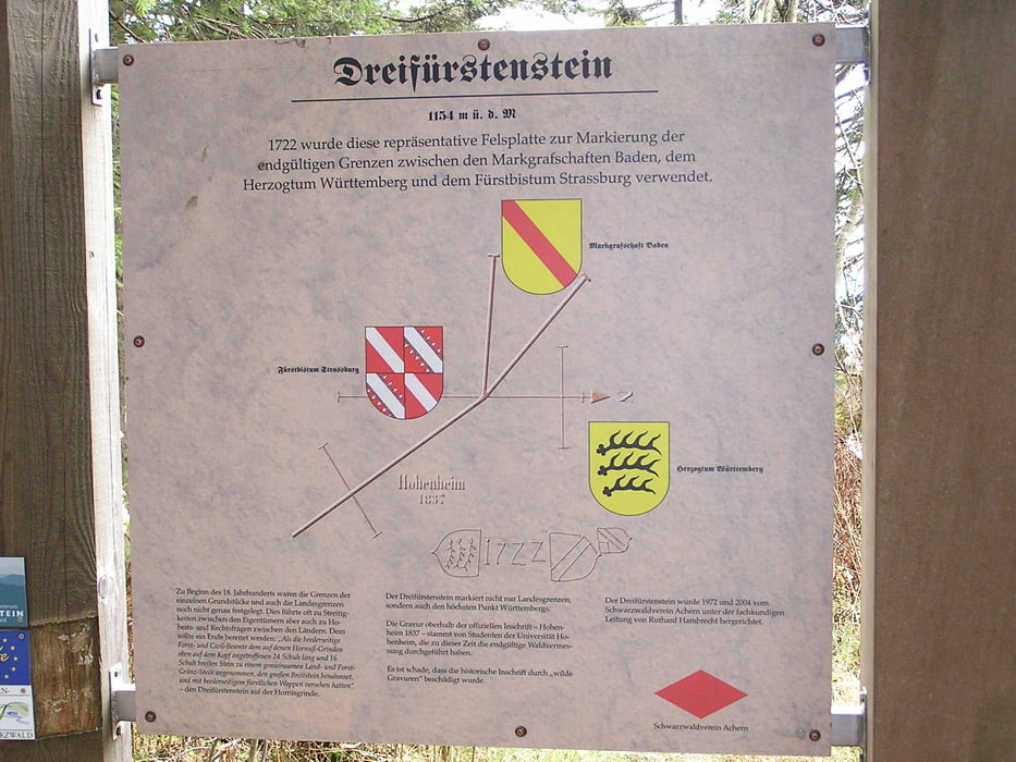
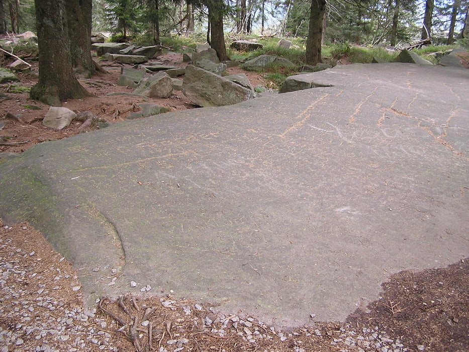
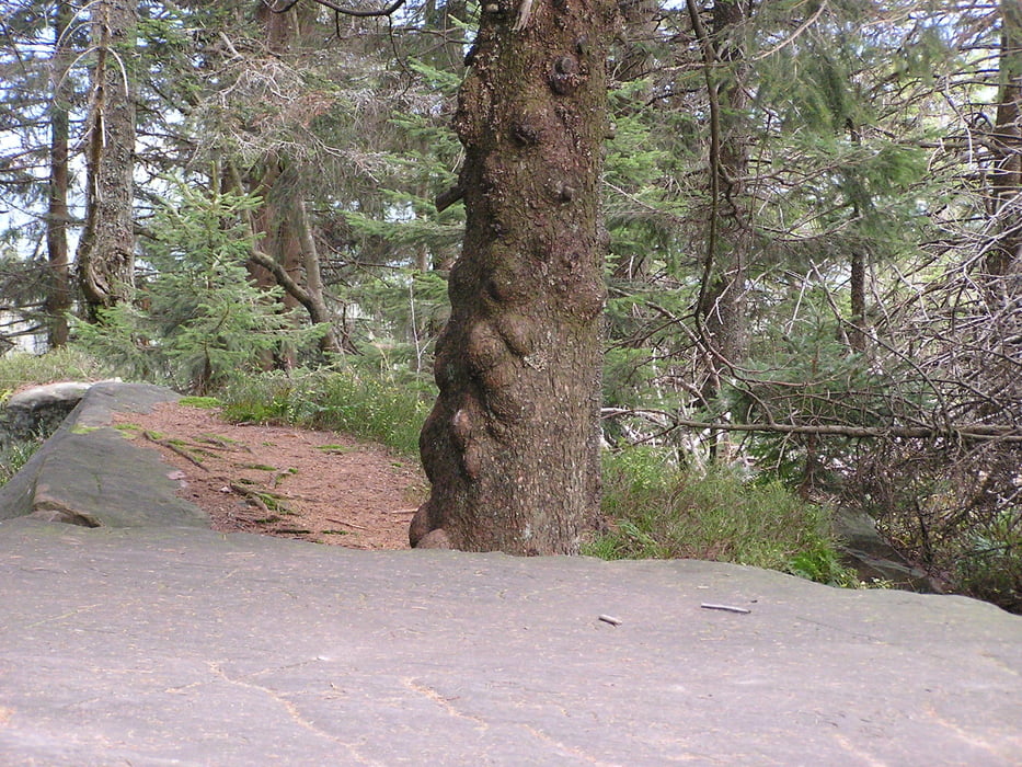
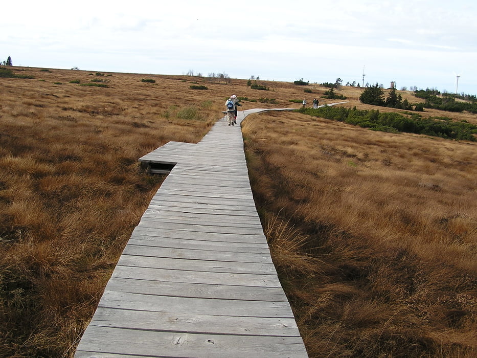
Ausgehend vom Parkplatz Mummelsee, den See umrunden, dann am Hotel vorbei zur Hornisgrindestraße, die Straße hoch ein Stück durch den Wald zum Dreifürsten Stein. Dann weiter auf dem wunderschönen holzbohlenweg durch das Hochmoor Hornisgrinde zum Aussichtsturm und danach wieder zurück zum Parkplatz Mummelsee.

Tour gallery

Tour map and elevation profile

  • Open Street Map
  • Google
Minimum height 1019 m Maximum height 1156 m Detailed view

More about the tour author

Klaus712
Member since 2008

Send private message

Comments

GPS tracks

Trackpoints
  • GPX / Garmin Map Source (gpx) download
  • TCX / Garmin Training Center® (tcx) download
  • CRS / Garmin Training Center® (crs) download
  • Google Earth (kml) download
  • G7ToWin (g7t) download
  • TTQV (trk) download
  • Overlay (ovl) download
  • Fugawi (txt) download
  • Kompass (DAV) Track (tk) download
  • Track data sheet (pdf) download
  • Original file of the author (gpx) download

More about the tour author

Klaus712
Member since 2008

Send private message
Share track
Add to my favorites
Remove from my favorites
Edit tags
My score
Rate
Track: Mummelsee Hornisgrinde
Type: Running
Distance: 5,1 km
Evaluated on:
Duration:
Day(s)
Hour(s)
Minute(s)
Score: Landscape Fun factor Fitness Technique