


Lac du Distroit is up at 2519m altitude at the southern tip of the Ecrins National Park. This walk starts from the trailhead in the Rabioux valley above Chateauroux les Alpes. The path climbs up from the valley floor on the south facing slopes under the steep slopes of the Chabreyret ridgeline. There is a marked contrast between the north and south facing slopes in this steep narrow valley with the former being colonised almost totally by conifers, Larch, Arolla pine, mountain pine and Scots pine. The south facing slopes on the other hand are abundant in deciduous trees as well as shrubs and bushes.
The previous day and night had been very wet and although today was forecast to be fine, there was still a lot of moisture in the air and on the ground. This built up low lying cloud during the morning that made for some spectacular views as we topped out above it.
Crossing over the torrent du Distroit we passed through an area with Helminthoid Flysch. This is a type of sedimentary rock, similar to slate, but with traces fossilised in it left behind by worms crawling on certain layers before they fossilised.
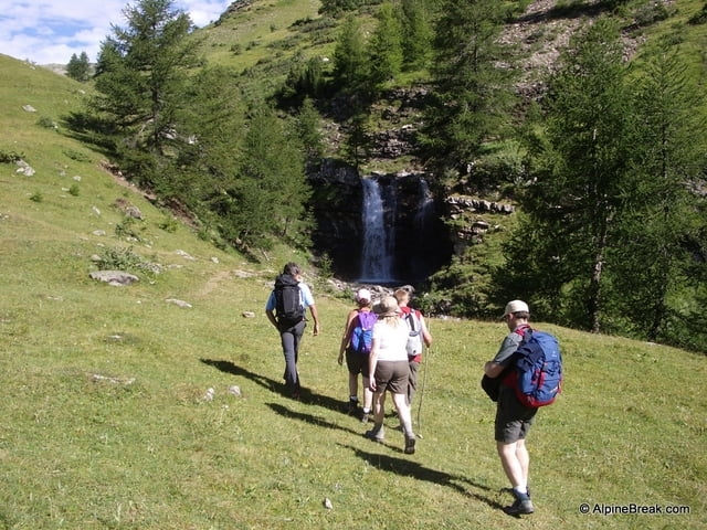
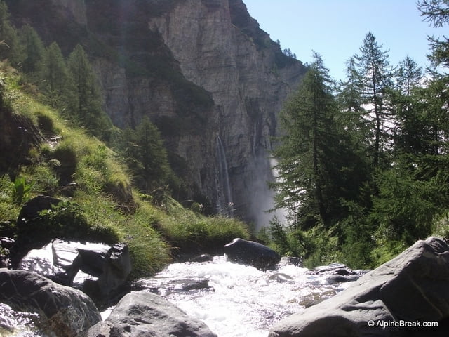
The valley then opens out to the large high alpine pastures of le Distroit with the chalets du Distroit off to the right of the path. There is a delightful waterfall in a little combe in the torrent. This area is a paradise for marmots with many of them visible all around, playing and enjoying the morning sun. Later in the day when the thermals have built up this will be a fine hunting ground for Golden eagles and the marmots will be much harder to spot.
The path continues past the higher shepherds hut at Clot Egout before rising steeply up the slopes of les Gourpes under the Croix de Razinette at 2456m. From here some undulating terrain brings you to the Lac du Distroit at 2519m.
After a short lunch we headed down the other side of the Tete des Maitz, down le Vallon, to a less well used path that passes under the Barre du Distroit. Here there were many cows grazing in this ample high pasture, irrigated by plenty of resurgences from the nevee, still melting in the scree slopes above.
The path then descends through the disused pastures of Piebran and its ruined cabin. During a break at this point we managed to spot the, also disued, nest of a golden eagle in the cliffs of the Barred du Distroit. The path back to the car park from here traverses through some ancient woodland with huge Larch trees that must be on the order of seven or eight hundred years old.
For great alpine walking holidays check out AlpineBreak.com
Further information at
http://alpinebreak.com/2008/photo/lac-du-distroit/Tour gallery


Tour map and elevation profile
Minimum height 1418 m
Maximum height 2526 m
More about the tour author
|
|
AlpineBreak |
Comments

GPS tracks
Trackpoints-
GPX / Garmin Map Source (gpx) download
-
TCX / Garmin Training Center® (tcx) download
-
CRS / Garmin Training Center® (crs) download
-
Google Earth (kml) download
-
G7ToWin (g7t) download
-
TTQV (trk) download
-
Overlay (ovl) download
-
Fugawi (txt) download
-
Kompass (DAV) Track (tk) download
-
Track data sheet (pdf) download
-
Original file of the author (gpx) download
More about the tour author
|
|
AlpineBreak |
Add to my favorites
Remove from my favorites
Edit tags
Open track
My score
Rate