


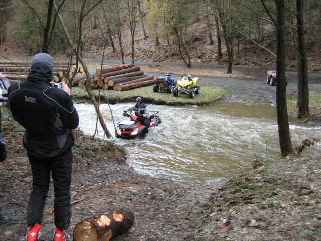
Quad-ATV Tour, Start und Ziel ist Kulmbach N50 06.015 E11 24.113, die Tour führt über Straßen, Wald und Feldwege, mit Wasserdurchfahrt.
Wichtig:
Bitte denkt an die Natur, teilweise gehts über Waldwege und Feldwegen die bei der Einfahrt nicht gespert sind oder man kein Sperrschild sieht, aber doch von anderer Seite eine Sperrung haben. Also Vorsicht!!!!!!!!
Ich übernehme keine Verantwortung bei Strafzetteln und Verletzung durch Schrotkugeln eines Jägers.
Diese Tour ist eine ATV-Wanderung, also nix zum heizen, die Natur wirds Euch danken!
Einkehren könnt Ihr in 95339 Wirsberg \"Zum Schorgasttal\" liegt direckt an der Strecke bei Abzweig in Wirsberg.
Noch einen wichtigen Tipp damit eure Traumtour nicht zur Tortur wird:
Kauft Eure GPS-Geräte beim Fachhändler, nur dieser kann dir die richtige Handhabung eines GPS-Gerätes erklären!!
Further information at
http://www.funmotor.infoTour gallery
Tour map and elevation profile
Minimum height 298 m
Maximum height 584 m
More about the tour author
|
|
funmotor |
Comments

GPS tracks
Trackpoints-
GPX / Garmin Map Source (gpx) download
-
TCX / Garmin Training Center® (tcx) download
-
CRS / Garmin Training Center® (crs) download
-
Google Earth (kml) download
-
G7ToWin (g7t) download
-
TTQV (trk) download
-
Overlay (ovl) download
-
Fugawi (txt) download
-
Kompass (DAV) Track (tk) download
-
Track data sheet (pdf) download
-
Original file of the author (gpx) download
More about the tour author
|
|
funmotor |
Add to my favorites
Remove from my favorites
Edit tags
Open track
My score
Rate