


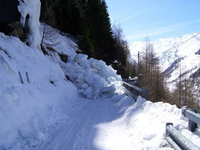
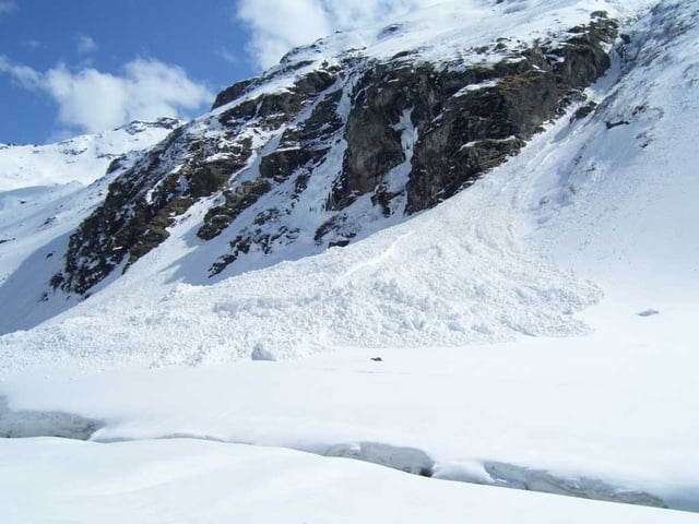
Der Aufstieg beginnt an der Ostseite der Staumauer. Zunächst oberhalb des Sees zum Südende (Sourier) Eisschlaggefahr! Dann das zunehmnd enger werden Tal empor, am Ende quert man auf die linke Seite. Lawinengefahr nach Neuschneefällen und Wärme!
Achtung! Die Hütte ist nicht da, wo in den Karten eingezeichnet, sondern weiter hinten.
Nicht der Beschilderung in Bonne folgen (Sommerweg, noch lawinengefährdeter, da Ostseite)
Sehr gemütliche Hütte und extrem netter Hüttenwirt und hervorragendes Essen ...
Bisher nicht überlaufen!
Tour gallery

Tour map and elevation profile
Minimum height 1737 m
Maximum height 2279 m
More about the tour author
|
|
hans-lauber |
Comments

Man nimmt die Strasse nach Bonne/Val Grisenche und fährt dann über die Staumauer auf die Ostseite der Staumauer. Hier Parkmöglichkeit.
GPS tracks
Trackpoints-
GPX / Garmin Map Source (gpx) download
-
TCX / Garmin Training Center® (tcx) download
-
CRS / Garmin Training Center® (crs) download
-
Google Earth (kml) download
-
G7ToWin (g7t) download
-
TTQV (trk) download
-
Overlay (ovl) download
-
Fugawi (txt) download
-
Kompass (DAV) Track (tk) download
-
Track data sheet (pdf) download
-
Original file of the author (gpx) download
More about the tour author
|
|
hans-lauber |
Add to my favorites
Remove from my favorites
Edit tags
Open track
My score
Rate