Login

Forgot your login?

Cookies have to be accepted!
Your browser's cookie functionality is disabled. Please enable this functionality.

Not a member yet?

Register now
Login

Available for registred users only

Log in to use this feature.

Forgot your login?

Cookies have to be accepted!
Your browser's cookie functionality is disabled. Please enable this functionality.

Not a member yet?

Register now
Filter
Categories
Advanced filters
  • Distance (km)
  • Height
Save filters Reset filter

TrackRank

QRCode

Technical data

Distance12,2 km Height169 m Way down372 m Duration04:00 h:m Date03.05.2009
Scores Author Landscape Fun factor Fitness Technique

Statistics

2036 Views Scores 375 Downloads Average
Rate
  • Track data sheet
  • Directions
  • Downloads
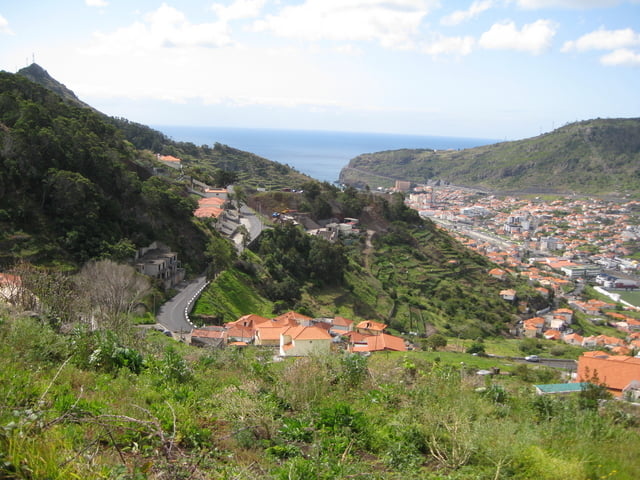
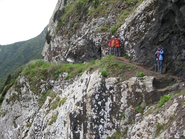
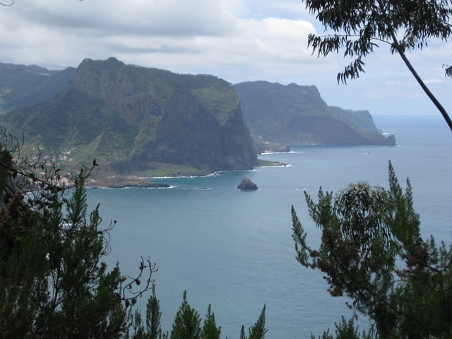
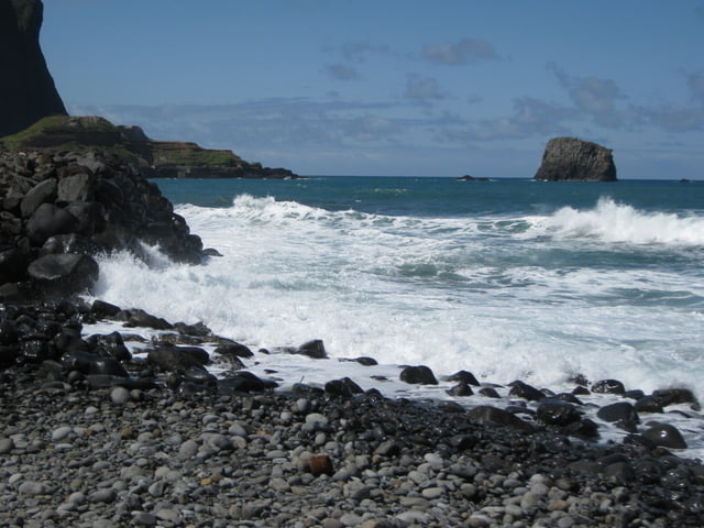
Diese Tour bietet viel: Eine Levada durch Gärten, Bergaufstieg zur Boca do Risco, Ausblicke über das Meer. Aussicht von der Ponta do Sao Lorenzo bis nach Santana.

Tour gallery

Tour map and elevation profile

  • Open Street Map
  • Google
Minimum height 10 m Maximum height 357 m Detailed view

More about the tour author

Heihopser
Member since 2009

Send private message

Comments

Wir haben unseren Mietwagen in Porto da Cruz abgestellt und uns mit einem Taxi zum alten Canical-Tunnel fahren lassen. (ca. 10 EUR)

GPS tracks

Trackpoints
  • GPX / Garmin Map Source (gpx) download
  • TCX / Garmin Training Center® (tcx) download
  • CRS / Garmin Training Center® (crs) download
  • Google Earth (kml) download
  • G7ToWin (g7t) download
  • TTQV (trk) download
  • Overlay (ovl) download
  • Fugawi (txt) download
  • Kompass (DAV) Track (tk) download
  • Track data sheet (pdf) download
  • Original file of the author (gpx) download

More about the tour author

Heihopser
Member since 2009

Send private message
Share track
Add to my favorites
Remove from my favorites
Edit tags
My score
Rate
Track: Canical-Tunnel nach Porto da Cruz
Type: Hiking
Distance: 12,2 km
Evaluated on:
Duration:
Day(s)
Hour(s)
Minute(s)
Score: Landscape Fun factor Fitness Technique