
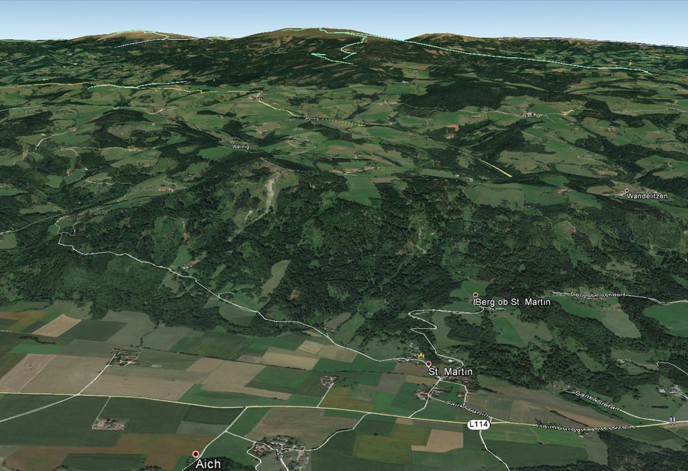

Moderater Anstieg von St. Martin aus auf sehr kleiner und kaum befahrener Asphaltstraße. Auf ca. 1000m Höhe auf einen anfangs recht kernigen Forstweg abzweigen. Der Forstweg wird später immer flacher und mündet schließlich in eine Wiese unterm Zauberkogel (höchster Punkt der Tour).
Nach einem kurzen Abstieg auf der gegenüberliegenden Seite der Wiese gehts vorwiegend auf Schotterwegen in südöstlicher Richtung bis zum Ort Wandelitzen. Auf diesem Abschnitt immer wieder super Ausblicke auf Unterkärnten.
In Wandelitzen rechts auf einen Wiesenweg abzweigen, der um einen kleinen Kogel herumführt und dann Richtung Ruine Rauterburg weiterführt. Von der Ruine weg schneller Abstieg am Forstweg bis zur Landesstraße, die man zurück nach St. Martin fährt.
Tour map and elevation profile
Minimum height 499 m
Maximum height 1138 m
More about the tour author

|
Martin74 |
Comments

A2 Südautobahn Abfahrt Völkermarkt Ost. Nach der Abfahrt ca. 2km Richtung Völkermarkt, dann rechts abbiegen Richtung Haimburg. In Haimburg links abbiegen. Ca. 5km bis zum Ausgangspunkt in St. Martin.
GPS tracks
Trackpoints-
GPX / Garmin Map Source (gpx) download
-
TCX / Garmin Training Center® (tcx) download
-
CRS / Garmin Training Center® (crs) download
-
Google Earth (kml) download
-
G7ToWin (g7t) download
-
TTQV (trk) download
-
Overlay (ovl) download
-
Fugawi (txt) download
-
Kompass (DAV) Track (tk) download
-
Track data sheet (pdf) download
-
Original file of the author (gpx) download
More about the tour author
|
|
Martin74 |
Add to my favorites
Remove from my favorites
Edit tags
Open track
My score
Rate