


Die Tour verläuft von Zittau über den Neiße-Radweg flußabwärts bis nach Görlitz. Im Höhenverlauf sind keine nennenswerten Steigungen zu erkennen. Die Beschaffenheit der Wege ist stark unterschiedlich und schwankt von sehr gut asphaltiert über Waldwege bis hin zu Kopfsteinpflaster. An die Kondition der Radfahrer wird keine große Anforderung gestellt. Die Strecke ist auch für Kinder geeignet.
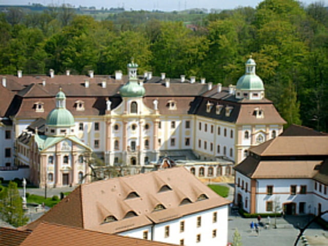
Besonders sehenswert ist neben den mittelalterlichen Städten Zittau und Görlitz das Kloster Marienthal in der Nähe von Ostritz (http://www.kloster-marienthal.de).
Der Abschnitt zwischen Zittau und Görlitz gehört zum Oder-Neiße-Radweg, der von Nova Ves in Tschechien bis nach Ahlbeck auf Usedom reicht.
Further information at
http://www.oderneisse-radweg.de/content/Tour gallery
Tour map and elevation profile
Minimum height 184 m
Maximum height 262 m
More about the tour author

|
dirkbadt |
Comments

Mit der Bahn ist Zittau von Dresden aus gut zu erreichen. Ebenso ist die Abfahrt von Görlitz mit der Bahn kein Problem.
GPS tracks
Trackpoints-
GPX / Garmin Map Source (gpx) download
-
TCX / Garmin Training Center® (tcx) download
-
CRS / Garmin Training Center® (crs) download
-
Google Earth (kml) download
-
G7ToWin (g7t) download
-
TTQV (trk) download
-
Overlay (ovl) download
-
Fugawi (txt) download
-
Kompass (DAV) Track (tk) download
-
Track data sheet (pdf) download
-
Original file of the author (gpx) download
More about the tour author
|
|
dirkbadt |
Add to my favorites
Remove from my favorites
Edit tags
Open track
My score
Rate