Login

Forgotten password?

Cookies have to be accepted!
Your browser's cookie functionality is disabled. Please enable this functionality.

Not a member yet?

Register now
Login

Available for registred users only

Log in to use this feature.

Forgotten password?

Cookies have to be accepted!
Your browser's cookie functionality is disabled. Please enable this functionality.

Not a member yet?

Register now
Filter
Categories
Advanced filters
  • Distance (km)
  • Height
Save filters Reset filter

TrackRank

QRCode

Technical data

Distance5,3 km Height732 m Way down0 m Duration03:30 h:m Date27.05.2009
Scores Author Landscape Fun factor Fitness Technique

Statistics

1692 Views Scores 240 Downloads Average
Rate
  • Track data sheet
  • Directions
  • Downloads

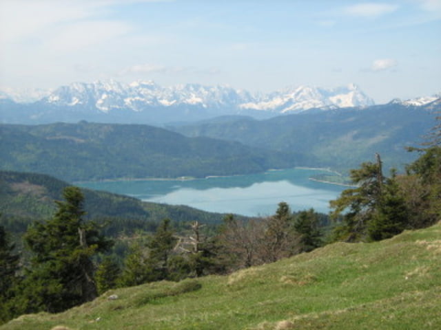
Vom großen Parkplatz in Jachenau Ort gehen wir Anfangs durch das Tal. Am Berg gehen wir stets steil durch den Wald nach oben Weiter über einen Bergrücken relativ flach bis zum Gipfel. Ist im Winter interessanter als im Sommer.


Tour gallery

Tour map and elevation profile

  • Open Street Map
  • Google
Minimum height 556 m Maximum height 1511 m Detailed view

More about the tour author

tazzo
Member since 2009

Send private message

Comments

In Jachenau Ort rechts der Kirche gibt es einen großen Parkplatz

GPS tracks

Trackpoints
  • GPX / Garmin Map Source (gpx) download
  • TCX / Garmin Training Center® (tcx) download
  • CRS / Garmin Training Center® (crs) download
  • Google Earth (kml) download
  • G7ToWin (g7t) download
  • TTQV (trk) download
  • Overlay (ovl) download
  • Fugawi (txt) download
  • Kompass (DAV) Track (tk) download
  • Track data sheet (pdf) download
  • Original file of the author (gpx) download

More about the tour author

tazzo
Member since 2009

Send private message
Share track
Add to my favorites
Remove from my favorites
Edit tags
My score
Rate
Track: Hirschhörnlkopf
Type: Hiking
Distance: 5,3 km
Evaluated on:
Duration:
Day(s)
Hour(s)
Minute(s)
Score: Landscape Fun factor Fitness Technique