


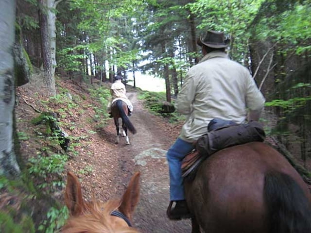
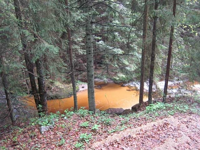
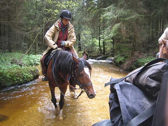
Tour 05 ist eine kürzere Tour nach einem Ruhetag mit kräftigem Regen. Ausgehend vom Wanderreiterhof Kern geht es zur Stonehill Ranch und zurück. Über Wildberg und Greinerschlag, zum Klammleitbach. Hier ein kurzer Aufenthalt im moorwasserhaltigen Bach, weiter in Richtung Haid ein Stück über den Güterweg Haid und über Diesenreith zur Stonehill Ranch, die am Fuß des Diesenberges liegt. Nach einem längeren Aufenthalt mit Jause, die nördliche Route über Landshut zurück - 13km, ca. 2 1/2 Stunden Reitzeit.
Auf meiner Homepage biete ich neben vielen Bildern und einer ausführlichen Beschreibung auch alle in dieser Region gerittenen Touren, sowie eine GPX-Datei mit allen markierten Reitwegen (Original-Wegenetz) zum Download an. Trackkarte mit Bildern
Further information at
http://www.wanderreiterweb.de/Tracks/OesterreichTour gallery
Tour map and elevation profile
Minimum height 732 m
Maximum height 887 m
More about the tour author
|
|
techno_face |
Comments

Ausgangspunkt ist der Reiterhof Kern bei Unterweißenbach
GPS tracks
Trackpoints-
GPX / Garmin Map Source (gpx) download
-
TCX / Garmin Training Center® (tcx) download
-
CRS / Garmin Training Center® (crs) download
-
Google Earth (kml) download
-
G7ToWin (g7t) download
-
TTQV (trk) download
-
Overlay (ovl) download
-
Fugawi (txt) download
-
Kompass (DAV) Track (tk) download
-
Track data sheet (pdf) download
-
Original file of the author (gpx) download
More about the tour author
|
|
techno_face |
Add to my favorites
Remove from my favorites
Edit tags
Open track
My score
Rate