


Rundwanderung unterm Stromboli
Einfach
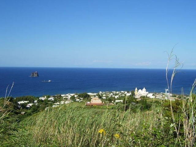
Am Ostende, vor dem Abstieg kann man bis auf 400m Höhe ansteigen und die Eruptionen (am besten bei Dunkelheit) beobachten. Siehe gesonderter Track von mir.
Am Ostende des Weges ist eine ziemlich teures Ristorante/Pizzeria, von der aus man im Dunkeln manchmal auch die Eruptionen verfolgen kann.
Tour gallery

Tour map and elevation profile
Minimum height -1 m
Maximum height 292 m
More about the tour author
|
|
hans-lauber |
Comments

Beginnt und endet an der Kirche.
Östlich, direkt neben der Kirche und einer Apotheke beginnt der Weg. Beschildert.
GPS tracks
Trackpoints-
GPX / Garmin Map Source (gpx) download
-
TCX / Garmin Training Center® (tcx) download
-
CRS / Garmin Training Center® (crs) download
-
Google Earth (kml) download
-
G7ToWin (g7t) download
-
TTQV (trk) download
-
Overlay (ovl) download
-
Fugawi (txt) download
-
Kompass (DAV) Track (tk) download
-
Track data sheet (pdf) download
-
Original file of the author (gpx) download
More about the tour author
|
|
hans-lauber |
Add to my favorites
Remove from my favorites
Edit tags
Open track
My score
Rate