


Schöne Rundtour im Anaga-Gebirge.
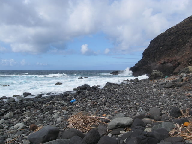
Der erste Teil der Tour bietet schöne Blicke in und um die Tamadite Schlucht. In Taganana lässt sich sehr gut eine Pause einlegen und in der ansässigen Bar lecker Ziegenfleisch oder Fisch essen. Ab dort bietet die Runde super Ausblicke auf das Meer. Die starke Brandung und der von großen Steinen gesäumte Strand lassen nur Mutige baden. Nichts spricht aber gegen die verdiente Abkühlung der wunden Füße vor dem anstrengenden Aufstieg nach Taborno. Der Weg dahin ist steil und stellenweise sehr verwachsen!
Alternativ kann man die Tour auch nur ab/bis Afur gehen (weiss/gelb ausgeschilderter Rückweg).
Tour gallery
Tour map and elevation profile
Minimum height 16 m
Maximum height 651 m
More about the tour author

|
herbys |
Comments

Mit Auto oder Bus nach Taborno. Achtung die Tour kann sehr lange dauern!
GPS tracks
Trackpoints-
GPX / Garmin Map Source (gpx) download
-
TCX / Garmin Training Center® (tcx) download
-
CRS / Garmin Training Center® (crs) download
-
Google Earth (kml) download
-
G7ToWin (g7t) download
-
TTQV (trk) download
-
Overlay (ovl) download
-
Fugawi (txt) download
-
Kompass (DAV) Track (tk) download
-
Track data sheet (pdf) download
-
Original file of the author (gpx) download
More about the tour author
|
|
herbys |
Add to my favorites
Remove from my favorites
Edit tags
Open track
My score
Rate