


Torbole - Arco - Dro - Pietramurata - Sarche –Castel Toblini - Vezzano - Ranzo
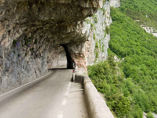
Die Strecke führt von Torbole auf dem Radweg nach Arco und hier über Nebenstrassen nach Dro. Von Dro bis Castel Toblini fährt man die stark befahrene Strasse bis man rechts nach Vezzano abzweigt einfach den Track folgen. Die Strasse nach Ranzo ist teilweise aus dem Felsen geschlagen und windet sich so den Steilhang hinauf. Endlang der Strasse Super Blicke auf das Castel Toblini und ins Sarcatal bis zum Lago. Von Ranzo fährt man die selbe Strecke retour. Die Route kann auch mit der Tour Lago Cavedine kombiniert werden.
Landschaftlich schöne Strecke mit Super Panorama Blicken bis zum Lago
Further information at
http://www.hotelcentraletorbole.it/Tour gallery
Tour map and elevation profile
Minimum height 69 m
Maximum height 772 m
More about the tour author

|
Comments

Start ist Torbole Zentrum da wir im Hotel Centrale gewohnt haben - sehr Empfehlenswerte Unterkunft.
GPS tracks
Trackpoints-
GPX / Garmin Map Source (gpx) download
-
TCX / Garmin Training Center® (tcx) download
-
CRS / Garmin Training Center® (crs) download
-
Google Earth (kml) download
-
G7ToWin (g7t) download
-
TTQV (trk) download
-
Overlay (ovl) download
-
Fugawi (txt) download
-
Kompass (DAV) Track (tk) download
-
Track data sheet (pdf) download
-
Original file of the author (gpx) download
More about the tour author
|
|
Add to my favorites
Remove from my favorites
Edit tags
Open track
My score
Rate