Login

Forgotten password?

Cookies have to be accepted!
Your browser's cookie functionality is disabled. Please enable this functionality.

Not a member yet?

Register now
Login

Available for registred users only

Log in to use this feature.

Forgotten password?

Cookies have to be accepted!
Your browser's cookie functionality is disabled. Please enable this functionality.

Not a member yet?

Register now
Filter
Categories
Advanced filters
  • Distance (km)
  • Height
Save filters Reset filter

TrackRank

QRCode

Technical data

Distance169,2 km Height551 m Way down807 m Duration08:00 h:m Date18.06.2006
Scores Author Landscape Fun factor Fitness Technique

Statistics

3315 Views Scores 597 Downloads Average
Rate
  • Track data sheet
  • Directions
  • Downloads
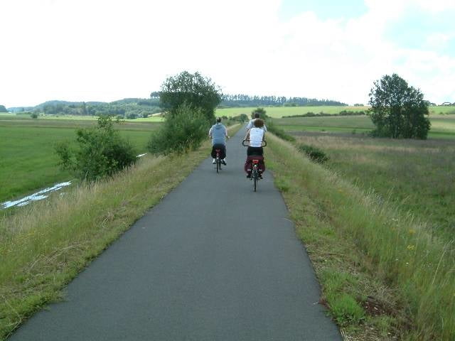
Die Fahhradtour führt über eine umgebaute Bahngleisstrecke von Daun nach Bernkastel Kues. Die Strecke ist angenehm zu fahren und auch für ungeübte Fahrradfahrer gut zu meistern. Wenn man von Daun aus startet geht sie fast nur bergab.

Further information at

http://www.tourendeddy.com

Tour map and elevation profile

  • Open Street Map
  • Google
Minimum height Maximum height 485 m Detailed view

More about the tour author

tourendeddy
Member since 2006

Send private message

Comments

Start Daun
Ende Bernkastel-kues

GPS tracks

Trackpoints
  • GPX / Garmin Map Source (gpx) download
  • TCX / Garmin Training Center® (tcx) download
  • CRS / Garmin Training Center® (crs) download
  • Google Earth (kml) download
  • G7ToWin (g7t) download
  • TTQV (trk) download
  • Overlay (ovl) download
  • Fugawi (txt) download
  • Kompass (DAV) Track (tk) download
  • Track data sheet (pdf) download
  • Original file of the author (gpx) download

More about the tour author

tourendeddy
Member since 2006

Send private message
Share track
Add to my favorites
Remove from my favorites
Edit tags
My score
Rate
Track: Maare Mosel Radweg
Type: Bicycle tours
Distance: 169,2 km
Evaluated on:
Duration:
Day(s)
Hour(s)
Minute(s)
Score: Landscape Fun factor Fitness Technique