


Schöne Tagestour.
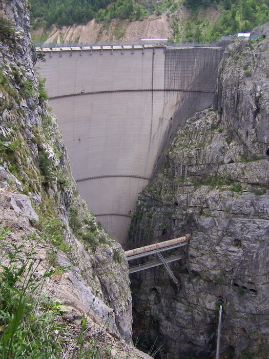
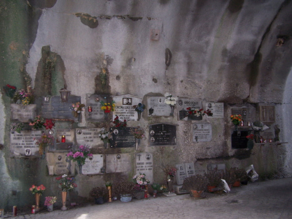
Der Vajont-Staudamm ist beeindruckend. Man sollte sich die Zeit nehmen die Gedenkstätte für die beinahe 2000 Opfer des Staudammunglücks von 1963 anzusehen. Der Ort Longarone wurde bei dem Unglück beinahe vollständig zerstört.
Die Fahrt über den Passo San Osvaldo ist eher unspektakulär, die Paßhöhe ist leicht zu übersehen.
Further information at
http://www.vajont.net/Tour gallery


Tour map and elevation profile
Minimum height 34 m
Maximum height 846 m
More about the tour author
|
|
kreidl |
Comments

Wir starteten die Tour von Levico Therme, da wir dort im Hotel Al Sorriso hervorragend übernachteten.
Die schnelle Variante der Anfahrt geht über den Brenner. Der Brenner Bundesstraße einfach bis Trento folgen und dann Richtung Levico Therme abbiegen.
Die schönere Variante geht über den Staller Sattel, dabei ist allerdings zu beschten, dass von Nord- nach Süd nur jeweils die letzten 15 MInuten jeder Stunde geöffnet ist. 45 MInuten steht die Ampel auf Rot. Die Wartezeit kann man sich allerdings mit einer Wurst oder einem Capuccino in einer der Hütten auf der Paßhöhe kurzweilig gestalten. Landschaft und Strecke sind eine kleine Wartezeit wert.
Nach dem Staller Sattel einfach grob in Richtung Rovereto orientieren.
GPS tracks
Trackpoints-
GPX / Garmin Map Source (gpx) download
-
TCX / Garmin Training Center® (tcx) download
-
CRS / Garmin Training Center® (crs) download
-
Google Earth (kml) download
-
G7ToWin (g7t) download
-
TTQV (trk) download
-
Overlay (ovl) download
-
Fugawi (txt) download
-
Kompass (DAV) Track (tk) download
-
Track data sheet (pdf) download
-
Original file of the author (gpx) download
More about the tour author
|
|
kreidl |
Add to my favorites
Remove from my favorites
Edit tags
Open track
My score
Rate