Login

Forgot your login?

Cookies have to be accepted!
Your browser's cookie functionality is disabled. Please enable this functionality.

Not a member yet?

Register now
Login

Available for registred users only

Log in to use this feature.

Forgot your login?

Cookies have to be accepted!
Your browser's cookie functionality is disabled. Please enable this functionality.

Not a member yet?

Register now
Filter
Categories
Advanced filters
  • Distance (km)
  • Height
Save filters Reset filter

TrackRank

QRCode

Technical data

Distance13,8 km Height287 m Way down282 m Duration01:10 h:m Date22.10.2009
Scores Author Landscape Fun factor Fitness Technique

Statistics

1247 Views Scores 466 Downloads Average
Rate
  • Track data sheet
  • Directions
  • Downloads

Schöne kleine Abendrunde mit interessantem Anstieg auf grobem Schotterweg.

Für die Anstrengung wird man durch beeindruckende Aussichten belohnt.

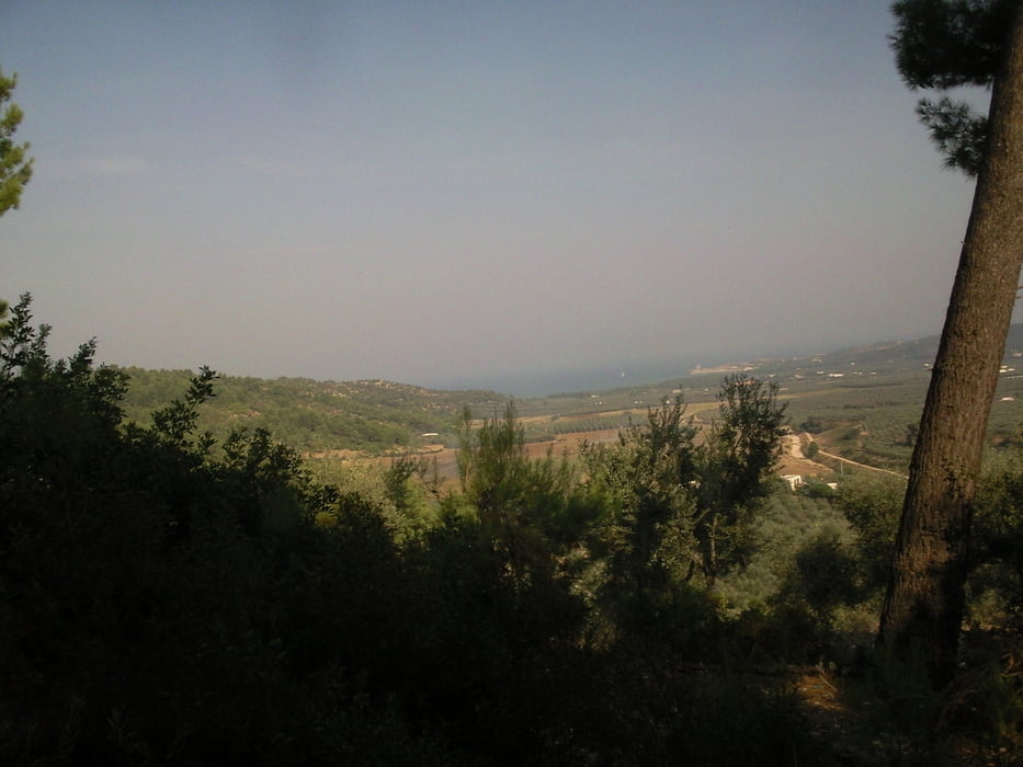
Mehrfach genießt man die hügelige Gargano- Landschaft, die sich an die tiefblaue Adria anschmiegt. 

Im Anschluss daran, gibt es eine heiße Singletrail- Abfahrt durch die Macchia

Incl. Durchquerung eines ausgetrockneten Flusses. 

Tour map and elevation profile

  • Open Street Map
  • Google
Minimum height 8 m Maximum height 264 m Detailed view

More about the tour author

erwin58
Member since 2009

Send private message

Comments

Schmidolino on 27.09.2011

Kleine Abendrunde

Feierabendrunde mit Spaßfaktor. Anspruchsvoller aber immer gut fahrbahrer Anstieg.
Toller Singletrail abwärts. Keine Schiebepssagen.
Danke und bitte mehr davon.
RainerV on 20.05.2018

Na ja...

"Kleine Abendrunde" scheint mir etwas untertrieben
corratec_mr on 14.06.2023

Kurze Runde

Kurze knackige Runde. Als Singletrail würde ich die Abfahrt nicht bezeichnen, dafür ist der Weg zu breit. Aber Spaß macht es trotzdem.
Einstieg ist zwischen Vieste und Peschici, bei Sfinale (Gargano-Bike-Trail) links bergauf.

GPS tracks

Trackpoints
  • GPX / Garmin Map Source (gpx) download
  • TCX / Garmin Training Center® (tcx) download
  • CRS / Garmin Training Center® (crs) download
  • Google Earth (kml) download
  • G7ToWin (g7t) download
  • TTQV (trk) download
  • Overlay (ovl) download
  • Fugawi (txt) download
  • Kompass (DAV) Track (tk) download
  • Track data sheet (pdf) download
  • Original file of the author (gpx) download

More about the tour author

erwin58
Member since 2009

Send private message
Share track
Add to my favorites
Remove from my favorites
Edit tags
My score
Rate
Track: Kleine Abendrunde
Type: Mountain bike
Distance: 13,8 km
Evaluated on:
Duration:
Day(s)
Hour(s)
Minute(s)
Score: Landscape Fun factor Fitness Technique