


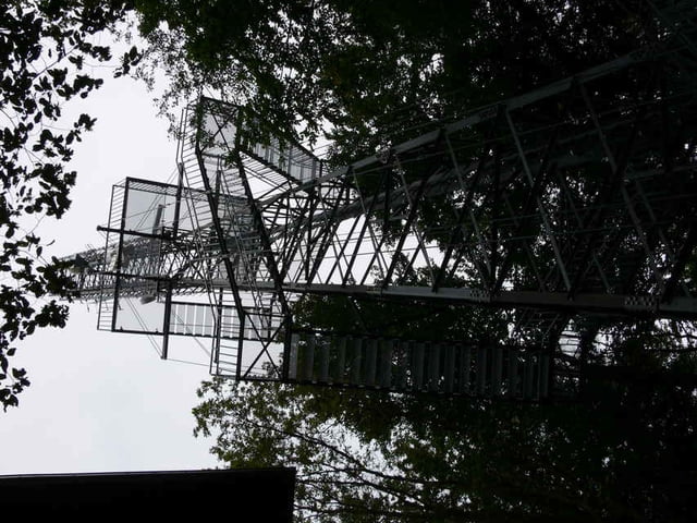
Die Tour startet beim Tennisclub Tullnerbach und führt durch dichte Mischwälder zur Troppbergwarte. Am Weg geht es vorbei an mehreren Gasthäusern und dem einen oder anderen schönen Fernblick. Die alte Warte ist längstens überwachsen und bietet schon lange keinen Ausblick mehr. Nebenan steht jedoch ein Handymasten mit einer Plattform, diese kann über etwas wacklige Stufen erreicht werden.
Further information at
http://www.gablitz.at/tourismus/wanderwege.html#tropphochTour gallery
Tour map and elevation profile
Minimum height 310 m
Maximum height 552 m
More about the tour author
|
|
gerhardg |
Comments

Der Hauptstraße durch Tullnerbach/Pressbaum folgen, beim Zielpunkt in die gegenüberliegene Straße in Richtung Norden einbiegen. Am Ende der Straße durch den Tunnel fahren und danach rechts den Berg bis zum Tennisclub hochfahren. Die Parkplätze sind etwas knapp, wer nichts findet kann auch beim Bahnhof parken.
GPS tracks
Trackpoints-
GPX / Garmin Map Source (gpx) download
-
TCX / Garmin Training Center® (tcx) download
-
CRS / Garmin Training Center® (crs) download
-
Google Earth (kml) download
-
G7ToWin (g7t) download
-
TTQV (trk) download
-
Overlay (ovl) download
-
Fugawi (txt) download
-
Kompass (DAV) Track (tk) download
-
Track data sheet (pdf) download
-
Original file of the author (gpx) download
More about the tour author
|
|
gerhardg |
Add to my favorites
Remove from my favorites
Edit tags
Open track
My score
Rate