Login

Forgot your login?

Cookies have to be accepted!
Your browser's cookie functionality is disabled. Please enable this functionality.

Not a member yet?

Register now
Login

Available for registred users only

Log in to use this feature.

Forgot your login?

Cookies have to be accepted!
Your browser's cookie functionality is disabled. Please enable this functionality.

Not a member yet?

Register now
Filter
Categories
Advanced filters
  • Distance (km)
  • Height
Save filters Reset filter

TrackRank

QRCode

Technical data

Distance31,0 km Height1374 m Way down1674 m Duration2 days 0 h Date15.05.2010
Scores Author Landscape Fun factor Fitness Technique

Statistics

300 Views Scores 26 Downloads Average
Rate
  • Track data sheet
  • Directions
  • Downloads

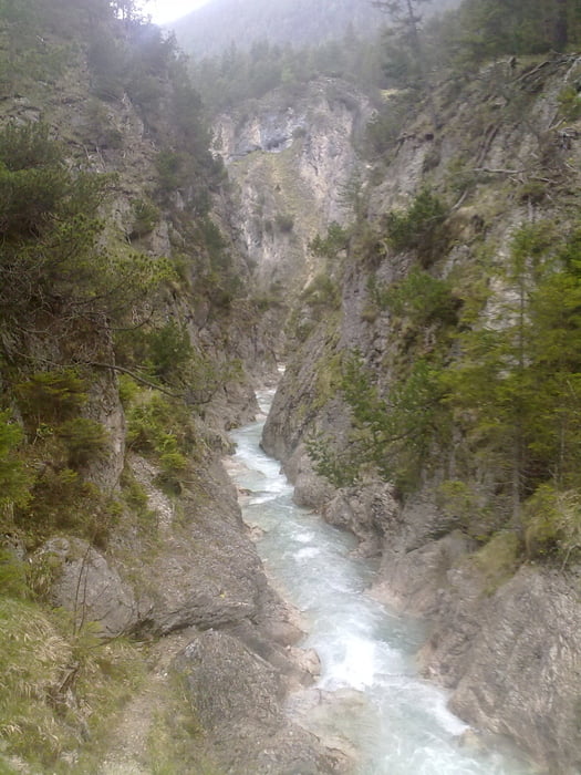
Day 1: From Scharnitz through Gleirschtal and Samertal to Pfeishütte

Day 2: Kreuzjöchl, descent into Inntal

Tour map and elevation profile

  • Open Street Map
  • Google
Minimum height 731 m Maximum height 2171 m Detailed view

More about the tour author

floppi
Member since 2008

Send private message

Comments

 By regional train from Innsbruck or Munich, stop: Scharnitz

GPS tracks

Trackpoints
  • GPX / Garmin Map Source (gpx) download
  • TCX / Garmin Training Center® (tcx) download
  • CRS / Garmin Training Center® (crs) download
  • Google Earth (kml) download
  • G7ToWin (g7t) download
  • TTQV (trk) download
  • Overlay (ovl) download
  • Fugawi (txt) download
  • Kompass (DAV) Track (tk) download
  • Track data sheet (pdf) download
  • Original file of the author (gpx) download

More about the tour author

floppi
Member since 2008

Send private message
Share track
Add to my favorites
Remove from my favorites
Edit tags
My score
Rate
Track: Karwendel Crossing
Type: Mountain hiking
Distance: 31,0 km
Evaluated on:
Duration:
Day(s)
Hour(s)
Minute(s)
Score: Landscape Fun factor Fitness Technique