


Die Radtour des MKK habe ich zweimal mitgeradelt (Sommer 2004 + 2008 ). Gestartet wurde in Gelnhausen. Ich spare mir die Aufzählung der Stationen, die könnt Ihr aus dem Track ersehen.
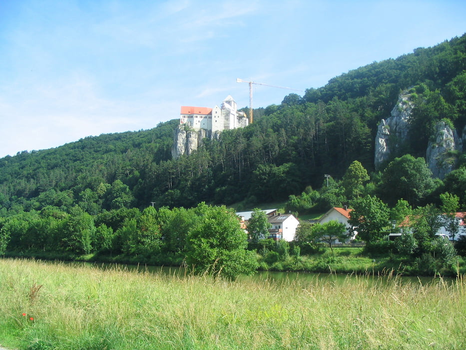
Es ist eine wunderschöne Radtour für die man sich eigentlich mehr als 7 Tage Zeit nehmen sollte. Es gibt sehr viel zu sehen. Unterkünfte die ich jederzeit wieder wählen würde habe ich als Wegpunkte belassen. Am allerbesten hat mir das Altmühltal gefallen. Es ist einfach super.
Ich habe in "MapSource" 7 Tracks sowohl im Format GDB als auch GPX. GPS-Tour.info macht daraus einen einzigen Track. Warum? In GPS-Tour.info erscheinen alle Daten, aber es wird kein Track gezeichnet. Ein Download im Format GPX zaubert jedoch ein vollständige Tourdatei.
Further information at
http://www.altmuehltal.de/Tour gallery


Tour map and elevation profile
Minimum height 106 m
Maximum height 492 m
More about the tour author
|
|
Bischemer |
Comments

Sie können die Tour in Gelnhausen oder auch an jeder beliebigen Stelle beginnen. Wenn Sie wenig Zeit haben, nutzen Sie Teilabschnitte.
GPS tracks
Trackpoints-
GPX / Garmin Map Source (gpx) download
-
TCX / Garmin Training Center® (tcx) download
-
CRS / Garmin Training Center® (crs) download
-
Google Earth (kml) download
-
G7ToWin (g7t) download
-
TTQV (trk) download
-
Overlay (ovl) download
-
Fugawi (txt) download
-
Kompass (DAV) Track (tk) download
-
Track data sheet (pdf) download
-
Original file of the author (gpx) download
More about the tour author
|
|
Bischemer |
Add to my favorites
Remove from my favorites
Edit tags
Open track
My score
Rate