Login

Forgot your login?

Cookies have to be accepted!
Your browser's cookie functionality is disabled. Please enable this functionality.

Not a member yet?

Register now
Login

Available for registred users only

Log in to use this feature.

Forgot your login?

Cookies have to be accepted!
Your browser's cookie functionality is disabled. Please enable this functionality.

Not a member yet?

Register now
Filter
Categories
Advanced filters
  • Distance (km)
  • Height
Save filters Reset filter

TrackRank

QRCode

Technical data

Distance14,8 km Height582 m Way down547 m Duration00:00 h:m Date13.06.2010
Scores Author Landscape Fun factor Fitness Technique

Statistics

286 Views Scores 62 Downloads Average
Rate
  • Track data sheet
  • Directions
  • Downloads

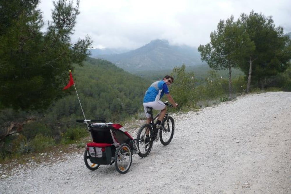
 Runde vom Campingplatz Herradura alles genial, Wahnsinns Landschaft und Ausblicke


Viel Spass

Further information at

http://de-de.facebook.com/group.php?gid=278437393114&ref=ts

Tour gallery

Tour map and elevation profile

  • Open Street Map
  • Google
Minimum height -18 m Maximum height 490 m Detailed view

More about the tour author

ckindler
Member since 2008

Send private message

Comments

 München Barcelona la Herradura


Gute Reise

GPS tracks

Trackpoints
  • GPX / Garmin Map Source (gpx) download
  • TCX / Garmin Training Center® (tcx) download
  • CRS / Garmin Training Center® (crs) download
  • Google Earth (kml) download
  • G7ToWin (g7t) download
  • TTQV (trk) download
  • Overlay (ovl) download
  • Fugawi (txt) download
  • Kompass (DAV) Track (tk) download
  • Track data sheet (pdf) download
  • Original file of the author (gpx) download

More about the tour author

ckindler
Member since 2008

Send private message
Share track
Add to my favorites
Remove from my favorites
Edit tags
My score
Rate
Track: La Herradura Runde
Type: Mountain bike
Distance: 14,8 km
Evaluated on:
Duration:
Day(s)
Hour(s)
Minute(s)
Score: Landscape Fun factor Fitness Technique