Login

Forgotten password?

Cookies have to be accepted!
Your browser's cookie functionality is disabled. Please enable this functionality.

Not a member yet?

Register now
Login

Available for registred users only

Log in to use this feature.

Forgotten password?

Cookies have to be accepted!
Your browser's cookie functionality is disabled. Please enable this functionality.

Not a member yet?

Register now
Filter
Categories
Advanced filters
  • Distance (km)
  • Height
Save filters Reset filter

TrackRank

QRCode

Technical data

Distance13,9 km Height1380 m Way down1329 m Duration05:00 h:m Date26.06.2010
Scores Author Landscape Fun factor Fitness Technique

Statistics

1670 Views Scores 106 Downloads Average
Rate
  • Track data sheet
  • Directions
  • Downloads

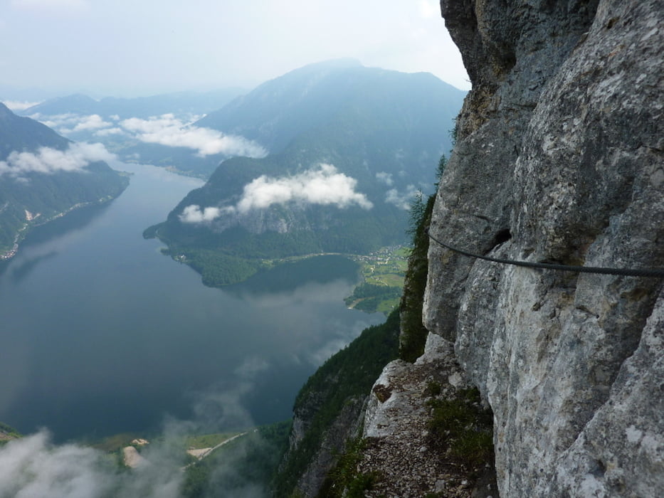
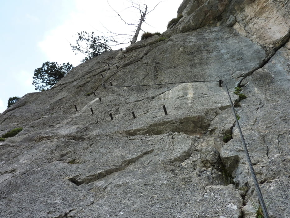
 Jedes Jahr ein Klassiker - traumhafter Klettersteig!

Bei nasser  Wand ist es sehr rutschig und man benötigt noch mehr Kraft als üblich. 

Nichts für Anfänger!

Tour gallery

Tour map and elevation profile

  • Open Street Map
  • Google
Minimum height 466 m Maximum height 1771 m Detailed view

More about the tour author

chp
Member since 2010

Send private message

Comments

GPS tracks

Trackpoints
  • GPX / Garmin Map Source (gpx) download
  • TCX / Garmin Training Center® (tcx) download
  • CRS / Garmin Training Center® (crs) download
  • Google Earth (kml) download
  • G7ToWin (g7t) download
  • TTQV (trk) download
  • Overlay (ovl) download
  • Fugawi (txt) download
  • Kompass (DAV) Track (tk) download
  • Track data sheet (pdf) download
  • Original file of the author (gpx) download

More about the tour author

chp
Member since 2010

Send private message
Share track
Add to my favorites
Remove from my favorites
Edit tags
My score
Rate
Track: Hallstatt Seewand-Klettersteig 20100626
Type: Via ferrata
Distance: 13,9 km
Evaluated on:
Duration:
Day(s)
Hour(s)
Minute(s)
Score: Landscape Fun factor Fitness Technique