

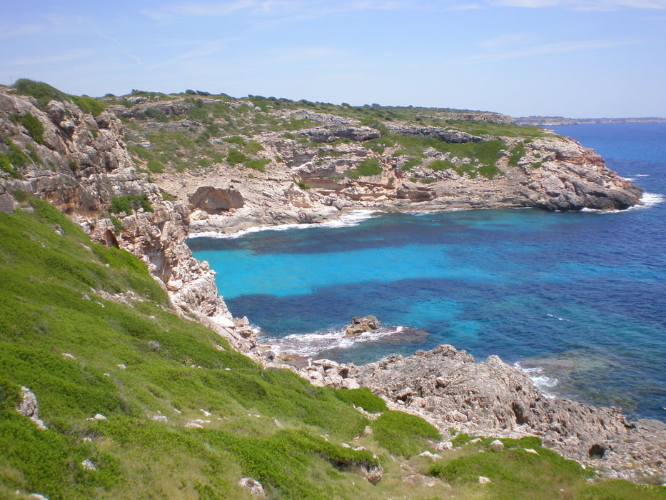
Die Tour ist im Rother Wanderführer Mallorca Nr 48 als Variante 2 beschrieben. Von den im Sommer recht vielen Autos nicht abschrecken lassen, fast alle wollen nur zur Platja des Caragol. Auf der Tour zur Calo Marmols war ,wenigstens als wir sie gingen, nichts los. Auch wenn das eine Küstenwanderung ist, mit Badeschlappen besser nicht angehen, der Weg wird recht steinig.
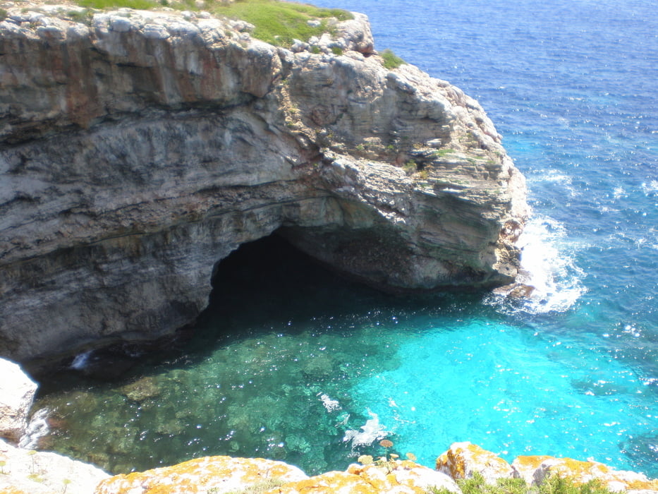
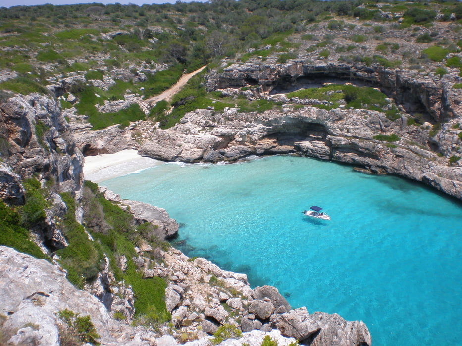
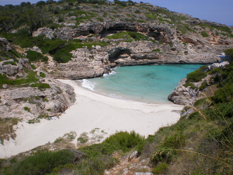
Am Leuchtturm wendet man sich zwischen diesem und der Küste an einem Mauerdurchbruch nach Osten ("links") und geht den mehr oder weniger deutlichen Küstenweg/pfad entlang bis zur Calo Marmols. Nach einem Badestopp geht es auf demselben Weg zurück
Tour gallery
Tour map and elevation profile
Minimum height -71 m
Maximum height 50 m
More about the tour author
|
|
Lanzarottl |
Comments

Auf der AM 6100 Colonia Sant Jordi - Santanyi zweigt zwischen Ses Salines und Llombards eine ca 10 km Straße zum Far des Cap des Salines ab. Sie endet direkt am Leuchtturm. Dort kann man parken.
GPS tracks
Trackpoints-
GPX / Garmin Map Source (gpx) download
-
TCX / Garmin Training Center® (tcx) download
-
CRS / Garmin Training Center® (crs) download
-
Google Earth (kml) download
-
G7ToWin (g7t) download
-
TTQV (trk) download
-
Overlay (ovl) download
-
Fugawi (txt) download
-
Kompass (DAV) Track (tk) download
-
Track data sheet (pdf) download
-
Original file of the author (gpx) download
More about the tour author
|
|
Lanzarottl |
Add to my favorites
Remove from my favorites
Edit tags
Open track
My score
Rate