Login

Forgotten password?

Cookies have to be accepted!
Your browser's cookie functionality is disabled. Please enable this functionality.

Not a member yet?

Register now
Login

Available for registred users only

Log in to use this feature.

Forgotten password?

Cookies have to be accepted!
Your browser's cookie functionality is disabled. Please enable this functionality.

Not a member yet?

Register now
Filter
Categories
Advanced filters
  • Distance (km)
  • Height
Save filters Reset filter

TrackRank

QRCode

Technical data

Distance20,1 km Height566 m Way down563 m Duration01:30 h:m Date22.07.2010
Scores Author User Landscape Fun factor Fitness Technique

Statistics

473 Views 1 Score 47 Downloads 4.00 Average
Rate
  • Track data sheet
  • Directions
  • Downloads

Feierabendtour von Bremthal zum Staufen und zurück (Variante)


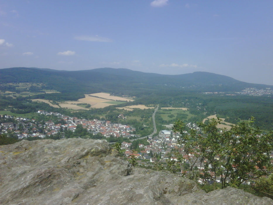
Start in Bremthal am Waldparkplatz, lockeres Einkurbeln bei leichter Steigung. Über ein paar Trails und Waldwege zum Einstieg in einen meiner Lieblingstrails runter nach Eppstein. Unten kurze Straßenstrecke, dann steil bergauf Richtung Staufen. Nach Schlaufe Richtung Gundelhard gehts über den kleinen Mannstein rauf zum großen Mannstein (Aussicht genießen: Feldberg + Frankfurt). Staufentrail bis runter an die Straße, ab Kurve kurz vor Eppstein wieder bergauf (die Strecke erinnert mich immer ein klein wenig an den Passo Lusia :-) ). Oben über den Judenkopf und dann Hauptweg bis zum Ziel brettern.

Tour map and elevation profile

  • Open Street Map
  • Google
Minimum height 174 m Maximum height 433 m Detailed view

More about the tour author

Taunusblicker
Member since 2009

Send private message

Comments

tims2801 on 02.03.2013

schöne Tour!

Bin die Tour gefahren! Ich fand sie als Einsteiger echt knackig und hab sie auch in der angegebenen Zeit nicht ganz geschafft! Musste einen Teil der zweiten Schleife auslassen weil die Anstiege echt knackig sind! Aber technisch sehr schöne Abfahrten und tolle Aussichten! Praktisch zum Parken.

Bremthal Ortsausfahrt Richtung Wildsachsen, hinter Sportplatz links auf Waldparkplatz.

GPS tracks

Trackpoints
  • GPX / Garmin Map Source (gpx) download
  • TCX / Garmin Training Center® (tcx) download
  • CRS / Garmin Training Center® (crs) download
  • Google Earth (kml) download
  • G7ToWin (g7t) download
  • TTQV (trk) download
  • Overlay (ovl) download
  • Fugawi (txt) download
  • Kompass (DAV) Track (tk) download
  • Track data sheet (pdf) download
  • Original file of the author (gpx) download

More about the tour author

Taunusblicker
Member since 2009

Send private message
Share track
Add to my favorites
Remove from my favorites
Edit tags
My score
Rate
Track: Bremthal - Staufen (Variante)
Type: Mountain bike
Distance: 20,1 km
Evaluated on:
Duration:
Day(s)
Hour(s)
Minute(s)
Score: Landscape Fun factor Fitness Technique