


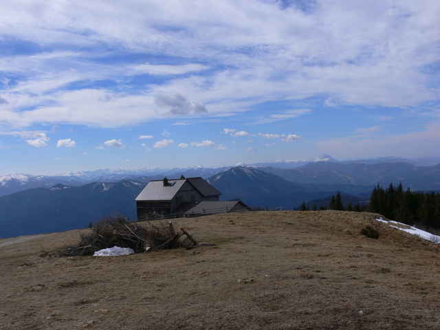
Abwechslungsreiche Tagestour von Kleinzell zum Reisalpenhaus und zurück. Die Landschaft wechselt mehrmals zwischen Wald und Almflächen, dazwischen immer wieder felsige Abschnitte. Das Schutzhaus eröffnet zwar erst im Mai, für ehrliche Wanderer gibt es im Notraum jedoch die Möglichkeit Getränke zu kaufen. Der Gipfel bietet einen Rundumblick ins Donautal, Traunstein, Hochschwab, Gippel, Göller, Peilstein, Rax,...
Beim Rückweg sollte man den sehenswerten Schneidergraben nicht auslassen.
Beim Rückweg sollte man den sehenswerten Schneidergraben nicht auslassen.
Further information at
http://www.oetk.at/index.htm?/huetten/34.htmTour gallery
Tour map and elevation profile
Minimum height 482 m
Maximum height 1404 m
More about the tour author
|
|
gerhardg |
Comments

A1 Abfahrt Alland - Altenmarkt - Hainfeld - Reinfeld - Kleinzell. Ausreichend Parkmöglichkeiten nahe der Kirche.
GPS tracks
Trackpoints-
GPX / Garmin Map Source (gpx) download
-
TCX / Garmin Training Center® (tcx) download
-
CRS / Garmin Training Center® (crs) download
-
Google Earth (kml) download
-
G7ToWin (g7t) download
-
TTQV (trk) download
-
Overlay (ovl) download
-
Fugawi (txt) download
-
Kompass (DAV) Track (tk) download
-
Track data sheet (pdf) download
-
Original file of the author (gpx) download
More about the tour author
|
|
gerhardg |
Add to my favorites
Remove from my favorites
Edit tags
Open track
My score
Rate