Login

Forgotten password?

Cookies have to be accepted!
Your browser's cookie functionality is disabled. Please enable this functionality.

Not a member yet?

Register now
Login

Available for registred users only

Log in to use this feature.

Forgotten password?

Cookies have to be accepted!
Your browser's cookie functionality is disabled. Please enable this functionality.

Not a member yet?

Register now
Filter
Categories
Advanced filters
  • Distance (km)
  • Height
Save filters Reset filter

TrackRank

QRCode

Technical data

Distance12,6 km Height596 m Way down601 m Duration03:55 h:m Date01.10.2010
Scores Author User Landscape Fun factor Fitness Technique

Statistics

10323 Views 1 Score 419 Downloads 4.00 Average
Rate
  • Track data sheet
  • Directions
  • Downloads

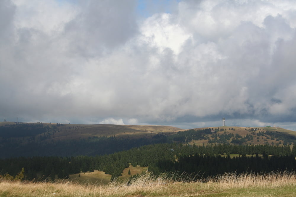
Sehr schöne Tour zum 2. höchsten Berg des Schwarzwaldes.

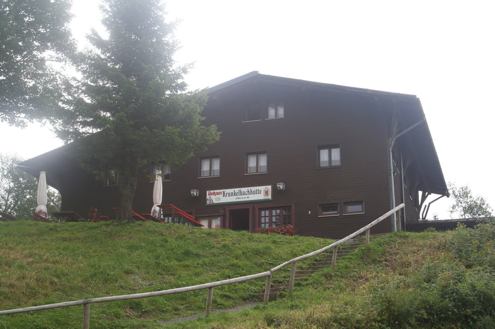
Start am Sportplatz von Bernau. Durch Bernau Dorf zur Krunkelbachhütte. (Kachelmann läßt grüssen) . Über Wiesen und schmale Wanderwege zum Gipfel.  Man muß auch über Quellen der Bergbäche gehen. Oben ein gigantischer Rundblick über unser Land. Und zurück auf Wanderwegen an der Bernauer Alb zum Sportplatz.

Tour gallery

Tour map and elevation profile

  • Open Street Map
  • Google
Minimum height 900 m Maximum height 1415 m Detailed view

More about the tour author

Seili
Member since 2008

Send private message

Comments

Eaton on 30.09.2011

Nette Wanderung

Die Tour machte ich bei herrlichstem Altweibersommerwetter am 29.09.2011.
Danke
Guest on 16.10.2011

Herzogenhorn

Im Schweizer Mittelland nur Nebel, auf den Strassen Richtung Süden/Berge Grosskampftag - eine ideale Tour :-)))

Von Freiburg kommend über die B31, Kirchzarten,Bärental, Feldberg nach Bernau.Oder durch das Münstertal und Schönau nach Bernau.

GPS tracks

Trackpoints
  • GPX / Garmin Map Source (gpx) download
  • TCX / Garmin Training Center® (tcx) download
  • CRS / Garmin Training Center® (crs) download
  • Google Earth (kml) download
  • G7ToWin (g7t) download
  • TTQV (trk) download
  • Overlay (ovl) download
  • Fugawi (txt) download
  • Kompass (DAV) Track (tk) download
  • Track data sheet (pdf) download
  • Original file of the author (gpx) download

More about the tour author

Seili
Member since 2008

Send private message
Share track
Add to my favorites
Remove from my favorites
Edit tags
My score
Rate
Track: Über die Krunkelbachhütte und das Herzogenhorn
Type: Hiking
Distance: 12,6 km
Evaluated on:
Duration:
Day(s)
Hour(s)
Minute(s)
Score: Landscape Fun factor Fitness Technique