Login

Forgot your login?

Cookies have to be accepted!
Your browser's cookie functionality is disabled. Please enable this functionality.

Not a member yet?

Register now
Login

Available for registred users only

Log in to use this feature.

Forgot your login?

Cookies have to be accepted!
Your browser's cookie functionality is disabled. Please enable this functionality.

Not a member yet?

Register now
Filter
Categories
Advanced filters
  • Distance (km)
  • Height
Save filters Reset filter

TrackRank

QRCode

Technical data

Distance24,0 km Height1153 m Way down1141 m Duration3 days 0 h Date14.10.2010
Scores Author Landscape Fun factor Fitness Technique

Statistics

637 Views 1 Score 66 Downloads 2.00 Average
Rate
  • Track data sheet
  • Directions
  • Downloads

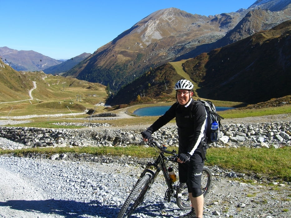
Dies war die erst Tour in meinem Tux Urlaub.

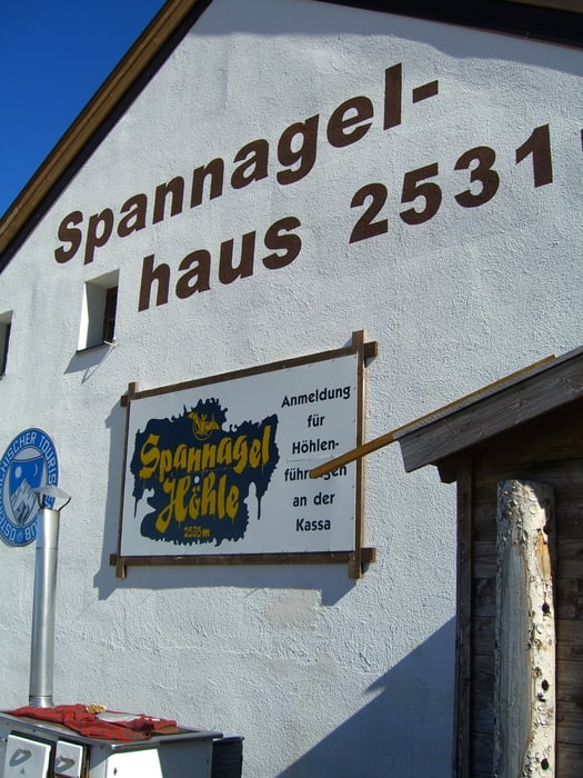
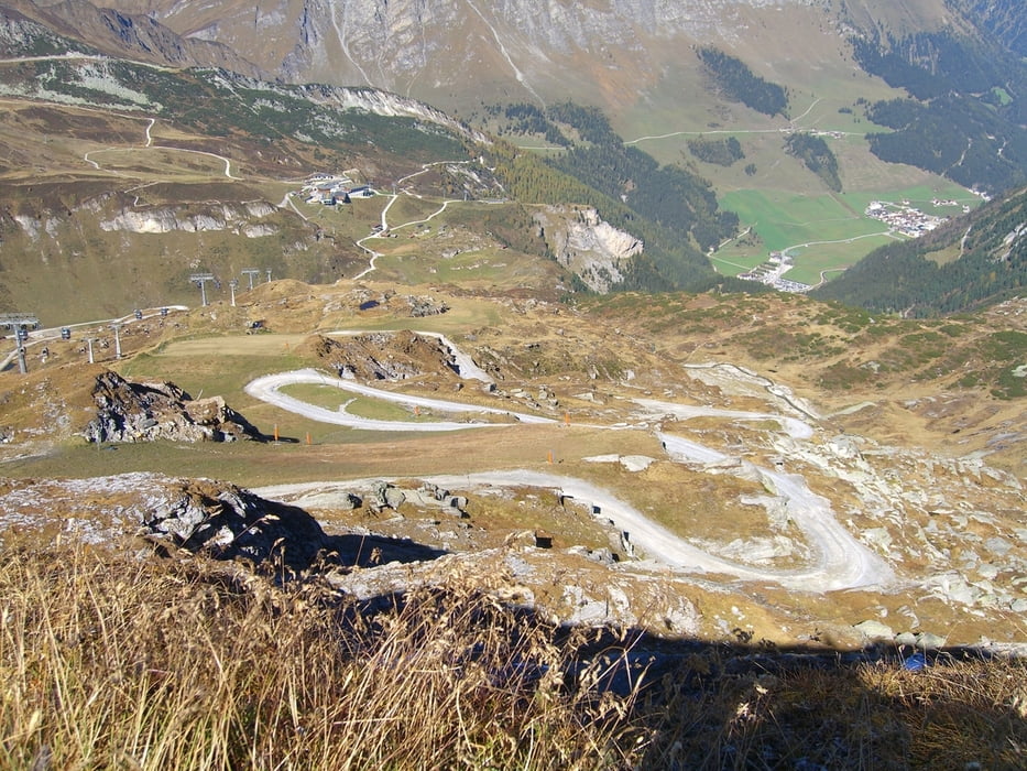
Die Strecke von der Sommerbergalm bis zum Spannnagelhaus ist schon heftig steil.
In diesem Stück spielt Technik keine Rolle ;-)
Ich bin Sie auch nicht ganz gefahren (teils geschoben).

Wer jedoch einmal mit dem Bike auf den Tuxer Gletscher möchte, kommt daran nicht vorbei.

500 Meter weiter und man hätte den Gletscher fühlen können.

Gruß
Georg


Tour gallery

Tour map and elevation profile

  • Open Street Map
  • Google
Minimum height 1416 m Maximum height 2552 m Detailed view

More about the tour author

gema75
Member since 2009

Send private message

Comments

klixx on 09.08.2017

Steilheit

"Heftig steil" trifft es recht gut. Dazu noch ein gerölliger Untergrund. Wer nicht gerade Beine wie King Kong hat, wird mehr als nur "teils" schieben. Wir haben sicher ab der Sommerbergalm die Hälfte der Höhenmeter geschoben. Im übrigen genauso wie die E-Mtb´ler. Selbst mit Motorunterstützung ging da nicht immer was. Der Ausblick ist schön, das Spannagelhaus jedoch ein Kommerztempel ohne Flair.

GPS tracks

Trackpoints
  • GPX / Garmin Map Source (gpx) download
  • TCX / Garmin Training Center® (tcx) download
  • CRS / Garmin Training Center® (crs) download
  • Google Earth (kml) download
  • G7ToWin (g7t) download
  • TTQV (trk) download
  • Overlay (ovl) download
  • Fugawi (txt) download
  • Kompass (DAV) Track (tk) download
  • Track data sheet (pdf) download
  • Original file of the author (gpx) download

More about the tour author

gema75
Member since 2009

Send private message
Share track
Add to my favorites
Remove from my favorites
Edit tags
My score
Rate
Track: Spannagelhaus
Type: Mountain bike
Distance: 24,0 km
Evaluated on:
Duration:
Day(s)
Hour(s)
Minute(s)
Score: Landscape Fun factor Fitness Technique