Login

Forgotten password?

Cookies have to be accepted!
Your browser's cookie functionality is disabled. Please enable this functionality.

Not a member yet?

Register now
Login

Available for registred users only

Log in to use this feature.

Forgotten password?

Cookies have to be accepted!
Your browser's cookie functionality is disabled. Please enable this functionality.

Not a member yet?

Register now
Filter
Categories
Advanced filters
  • Distance (km)
  • Height
Save filters Reset filter

TrackRank

QRCode

Technical data

Distance29,3 km Height429 m Way down372 m Duration01:56 h:m Date31.10.2010
Scores Author User Landscape Fun factor Fitness Technique

Statistics

2733 Views 4 Scores 354 Downloads 4.50 Average
Rate
  • Track data sheet
  • Directions
  • Downloads

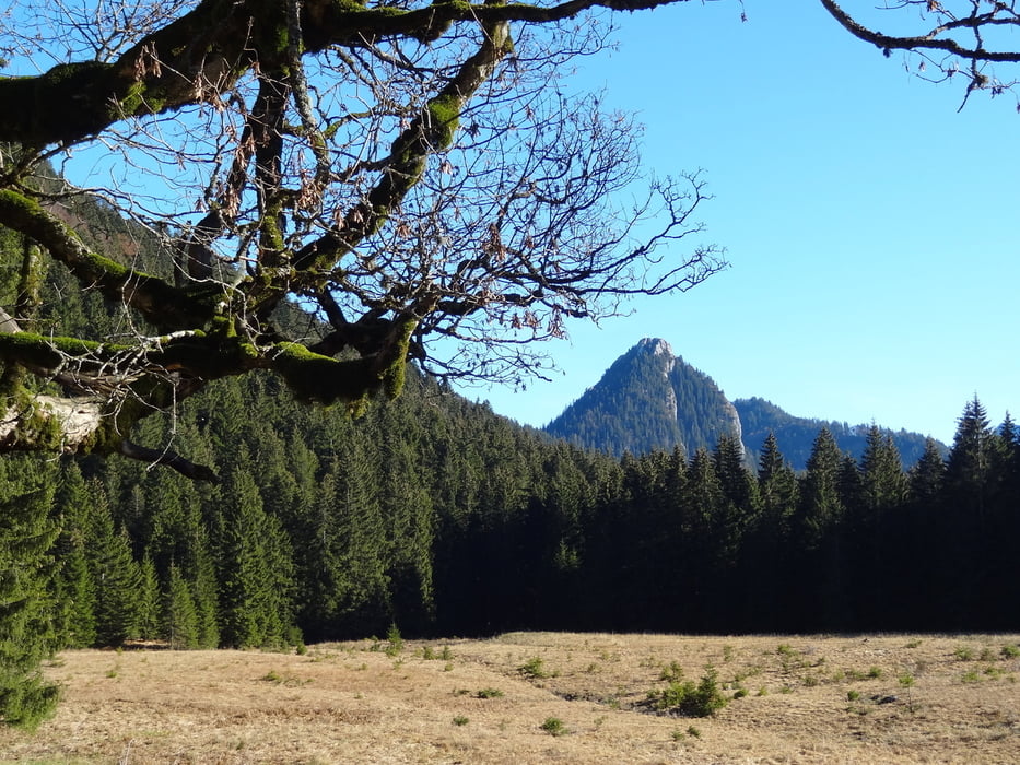
Schöne Kurztour ducrh das Söllbachtal zur Schwarzentennalm. Unterhalb (westl) von Wildbad Kreuth gibt's hervorragende frisch geräucherte Saiblinge und Forellen.

Tour gallery

Tour map and elevation profile

  • Open Street Map
  • Google
Minimum height 775 m Maximum height 1102 m Detailed view

More about the tour author

Traenkerluis
Member since 2010

Send private message

Comments

Tracer on 17.09.2011

Schöne Tour

Ich bin diese Tour heute gefahren und muss sagen, es ist eine schöne Tour, nur wenige wirklich steile Steigungen. Wegen dem tollen Wetter waren viele Leute unterwegs, das stört aber nicht, da es nur breite Waldwege sind...

Parken am Wanderparkplatz Söllbachtal

GPS tracks

Trackpoints
  • GPX / Garmin Map Source (gpx) download
  • TCX / Garmin Training Center® (tcx) download
  • CRS / Garmin Training Center® (crs) download
  • Google Earth (kml) download
  • G7ToWin (g7t) download
  • TTQV (trk) download
  • Overlay (ovl) download
  • Fugawi (txt) download
  • Kompass (DAV) Track (tk) download
  • Track data sheet (pdf) download
  • Original file of the author (gpx) download

More about the tour author

Traenkerluis
Member since 2010

Send private message
Share track
Add to my favorites
Remove from my favorites
Edit tags
My score
Rate
Track: BadWiessee-Söllbachtal-Schwarzentennalm-WildbadKreuth-Kreuth-Egern-BadWiessee
Type: Mountain bike
Distance: 29,3 km
Evaluated on:
Duration:
Day(s)
Hour(s)
Minute(s)
Score: Landscape Fun factor Fitness Technique