


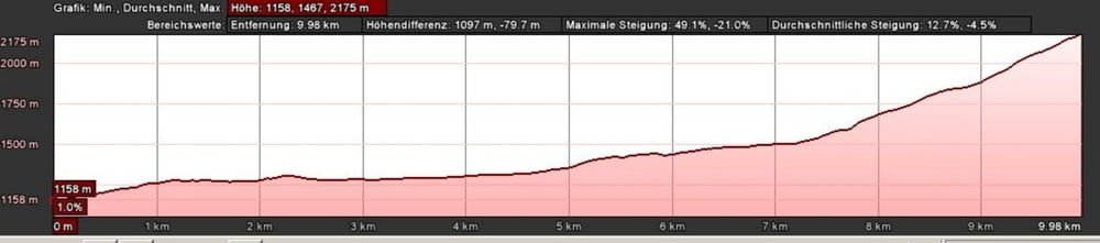
Achtung: der Aufstieg wurde nicht per GPS getrackt sondern mit Google-Earth nachgezeichnet. Leider habe ich es nicht geschafft die Höhenangeben des Aufstiegs aus Google-Earth zu exportieren. Daher gibt es nur ein Höhenprofil für die Abfahrt.
Achtung: Wir waren nicht ganz auf dem Gipfel der Lungauer Kalkspitze, sondern sind schon vorher wieder von einem Pass abgefahren.
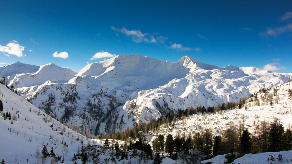
Langer flacher Zustieg durch ein sehr malerisches Tal bevor es dann zügig in einer sehr abwechslungsreichen Route bergauf geht. Traumhafte Abfahrt, dann geht es jedoch wieder flach aus zwei Tälern raus. Also für Snowboardfahrer nur bedingt geeignet.
Am Parkplatz gibt es dann noch eine uhrige Hütte.
Tour gallery
Tour map and elevation profile
Minimum height 1166 m
Maximum height 2153 m
More about the tour author

|
mini3000 |
Comments

GPS tracks
Trackpoints-
GPX / Garmin Map Source (gpx) download
-
TCX / Garmin Training Center® (tcx) download
-
CRS / Garmin Training Center® (crs) download
-
Google Earth (kml) download
-
G7ToWin (g7t) download
-
TTQV (trk) download
-
Overlay (ovl) download
-
Fugawi (txt) download
-
Kompass (DAV) Track (tk) download
-
Track data sheet (pdf) download
-
Original file of the author (gpx) download
More about the tour author
|
|
mini3000 |
Add to my favorites
Remove from my favorites
Edit tags
Open track
My score
Rate