Login

Forgot your login?

Cookies have to be accepted!
Your browser's cookie functionality is disabled. Please enable this functionality.

Not a member yet?

Register now
Login

Available for registred users only

Log in to use this feature.

Forgot your login?

Cookies have to be accepted!
Your browser's cookie functionality is disabled. Please enable this functionality.

Not a member yet?

Register now
Filter
Categories
Advanced filters
  • Distance (km)
  • Height
Save filters Reset filter

TrackRank

QRCode

Technical data

Distance10,8 km Height628 m Way down599 m Duration04:30 h:m Date24.01.2011
Scores Author Landscape Fun factor Fitness Technique

Statistics

747 Views Scores 26 Downloads Average
Rate
  • Track data sheet
  • Directions
  • Downloads

Krožen izlet prek Vodic in Svete Gore nad Novo Gorico.

Further information at

http://potepanja-v-naravi.blogspot.com/2011/01/vodice-in-sveta-gora.html

Tour gallery

Tour map and elevation profile

  • Open Street Map
  • Google
Minimum height 251 m Maximum height 688 m Detailed view

More about the tour author

ExAmigan
Member since 2009

Send private message

Comments

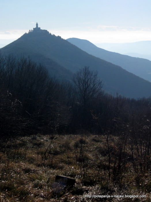
Pri Solkanu zavijemo proti Sveti Gori in se po cesti vzpenjamo vse do prvega ostrega desnega ovinka, kjer je na zunanji strani v gozdu manjše parkirišče.

GPS tracks

Trackpoints
  • GPX / Garmin Map Source (gpx) download
  • TCX / Garmin Training Center® (tcx) download
  • CRS / Garmin Training Center® (crs) download
  • Google Earth (kml) download
  • G7ToWin (g7t) download
  • TTQV (trk) download
  • Overlay (ovl) download
  • Fugawi (txt) download
  • Kompass (DAV) Track (tk) download
  • Track data sheet (pdf) download
  • Original file of the author (gpx) download

More about the tour author

ExAmigan
Member since 2009

Send private message
Share track
Add to my favorites
Remove from my favorites
Edit tags
My score
Rate
Track: Vodice in Sveta Gora
Type: Mountain hiking
Distance: 10,8 km
Evaluated on:
Duration:
Day(s)
Hour(s)
Minute(s)
Score: Landscape Fun factor Fitness Technique