


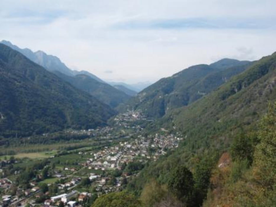
Rundwanderung von Avegno, zuerst durch das Maggia-Tal bis Ponte Brolla, dann der Anstieg mit Blick ins Centovalli, vorbei an einer Kapelle durch ein sehr romantisches Hochtal mit Rusticos. Man könnte glauben, dass gleich ein paar Hobbits um die Ecke kommen! Hier gab es auch eine Einkehrmöglichkeit. Anschließend geht es wieder ins Maggiatal und zurück bis Avegno
Tour gallery


Tour map and elevation profile
Minimum height 262 m
Maximum height 631 m
More about the tour author

|
wanderer_09 |
Comments

Von Locarno sehr gute Busverbindung, die Linie durch das Maggiatal.
GPS tracks
Trackpoints-
GPX / Garmin Map Source (gpx) download
-
TCX / Garmin Training Center® (tcx) download
-
CRS / Garmin Training Center® (crs) download
-
Google Earth (kml) download
-
G7ToWin (g7t) download
-
TTQV (trk) download
-
Overlay (ovl) download
-
Fugawi (txt) download
-
Kompass (DAV) Track (tk) download
-
Track data sheet (pdf) download
-
Original file of the author (gpx) download
More about the tour author
|
|
wanderer_09 |
Add to my favorites
Remove from my favorites
Edit tags
Open track
My score
Rate