


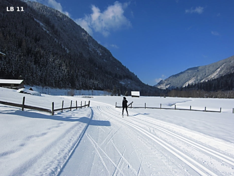
The skating trail in Rohrmoos-Untertal has a length of 13.2 km and 181 altimeters. Apart from the 3 hard climbs at the restaurant Tetter and by the pasture Angereralm the skating track is classified as easy. Who wants to have more sunshine during skating run should start the cross-country tour in Rohrmoos-Untertal better in the morning, as the beautiful, high mountains shade the basin early in the afternoon.
More infos, photos and video you'll find on biketours4you.at
Die Skating Loipe in Rohrmoos-Untertal hat eine Länge von 13,2 km und insgesamt 181 Höhenmeter. Abgesehen von den 3 anstrengenden Steigungen beim Gasthof Tetter und der Angereralm ist die Skatingloipe als leicht einzustufen. Wer beim Langlaufen mehr Sonnenschein haben möchte sollte die Langlauftour in Rohrmoos-Untertal besser am Vormittag einplanen, da die schönen, hohen Berge am Nachmittag ziemlich früh das Talbecken beschatten.
Mehr Infos, Fotos und Video findest du auf biketours4you.at
Tour gallery
Tour map and elevation profile
Minimum height 988 m
Maximum height 1096 m
More about the tour author
|
|
Trek1400d |
Comments

GPS tracks
Trackpoints-
GPX / Garmin Map Source (gpx) download
-
TCX / Garmin Training Center® (tcx) download
-
CRS / Garmin Training Center® (crs) download
-
Google Earth (kml) download
-
G7ToWin (g7t) download
-
TTQV (trk) download
-
Overlay (ovl) download
-
Fugawi (txt) download
-
Kompass (DAV) Track (tk) download
-
Track data sheet (pdf) download
-
Original file of the author (gpx) download
More about the tour author
|
|
Trek1400d |
Add to my favorites
Remove from my favorites
Edit tags
Open track
My score
Rate