


Los gehts in Mannheim Waldhof. Dann Richtung Heddesheim. Von Heddesheim nach Grosssachsen. Weiter nach Heiligenkreuz und dort rechts hoch über den schönen Apfelbaumweg nach Rippenweier. Über einen gut zu fahrenden Feldweg nach Ober-Flockenbach. Weiter über Unter-Flockenbach, Gorxheim nach Weinheim und Viernheim. Von Viernheim über gute Feldwege zurück nach Mannheim.
Tour gallery
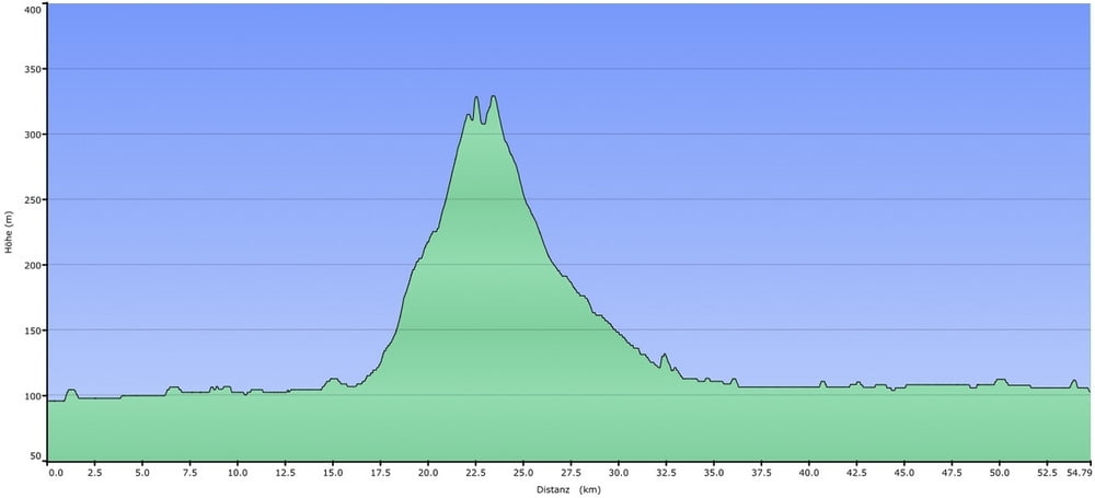
Tour map and elevation profile
Minimum height 95 m
Maximum height 329 m
More about the tour author
|
|
nattermt |
Comments

Mannheim Waldhof ist Ausgangspunt der Tour. Parkmöglichkeiten am Bahnhof oder direkt im Wohngebiet Waldhof.
GPS tracks
Trackpoints-
GPX / Garmin Map Source (gpx) download
-
TCX / Garmin Training Center® (tcx) download
-
CRS / Garmin Training Center® (crs) download
-
Google Earth (kml) download
-
G7ToWin (g7t) download
-
TTQV (trk) download
-
Overlay (ovl) download
-
Fugawi (txt) download
-
Kompass (DAV) Track (tk) download
-
Track data sheet (pdf) download
-
Original file of the author (gpx) download
More about the tour author
|
|
nattermt |
Add to my favorites
Remove from my favorites
Edit tags
Open track
My score
Rate