Login

Forgotten password?

Cookies have to be accepted!
Your browser's cookie functionality is disabled. Please enable this functionality.

Not a member yet?

Register now
Login

Available for registred users only

Log in to use this feature.

Forgotten password?

Cookies have to be accepted!
Your browser's cookie functionality is disabled. Please enable this functionality.

Not a member yet?

Register now
Filter
Categories
Advanced filters
  • Distance (km)
  • Height
Save filters Reset filter

TrackRank

QRCode

Technical data

Distance226,3 km Height6317 m Way down6330 m Duration09:04 h:m Date22.04.2011
Scores Author Landscape Fun factor Fitness Technique

Statistics

717 Views Scores 146 Downloads Average
Rate
  • Track data sheet
  • Directions
  • Downloads


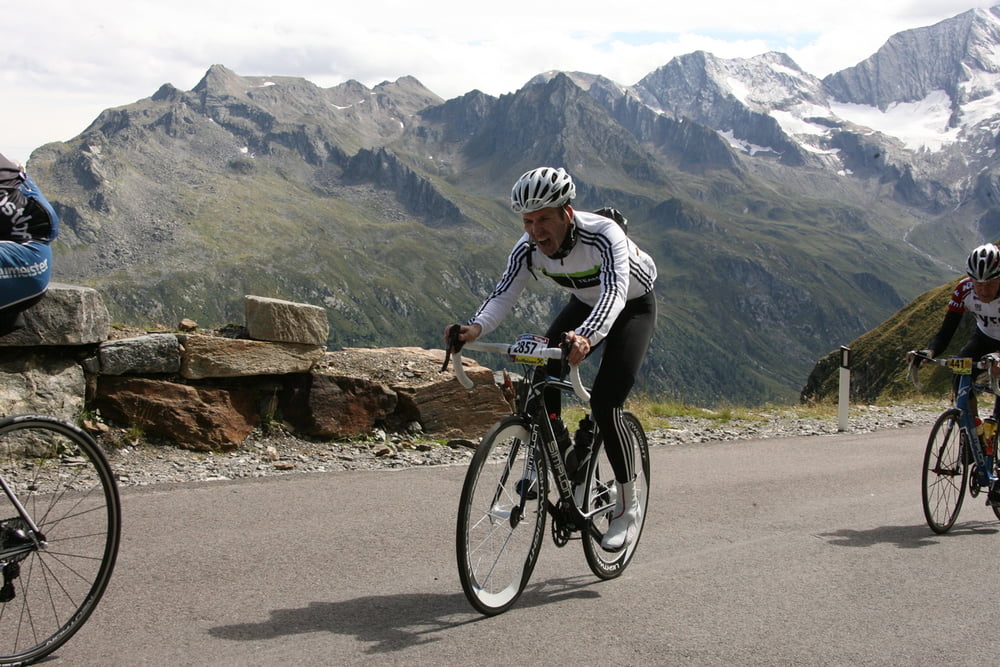
Altbekannter Kultradmarathon in Österreich; 29.08.2010; erste Teilnahme, Anspruch total unterschätzt, mit unzähligen Krämpfen in der Auffahrt zum Timmelsjoch 'gestorben'; finalen Anstieg zur Mautstation vor der Abfahrt nach Sölden geschoben. Zielzeit von 08:15h um fast 50 Min verfehlt.


Tour map and elevation profile

  • Open Street Map
  • Google
Minimum height 576 m Maximum height 2477 m Detailed view

More about the tour author

BikeEnthusiast
Member since 2008

Send private message

Comments

GPS tracks

Trackpoints
  • GPX / Garmin Map Source (gpx) download
  • TCX / Garmin Training Center® (tcx) download
  • CRS / Garmin Training Center® (crs) download
  • Google Earth (kml) download
  • G7ToWin (g7t) download
  • TTQV (trk) download
  • Overlay (ovl) download
  • Fugawi (txt) download
  • Kompass (DAV) Track (tk) download
  • Track data sheet (pdf) download
  • Original file of the author (gpx) download

More about the tour author

BikeEnthusiast
Member since 2008

Send private message
Share track
Add to my favorites
Remove from my favorites
Edit tags
My score
Rate
Track: Ötztaler Radmarathon 2010
Type: Road biking
Distance: 226,3 km
Evaluated on:
Duration:
Day(s)
Hour(s)
Minute(s)
Score: Landscape Fun factor Fitness Technique