


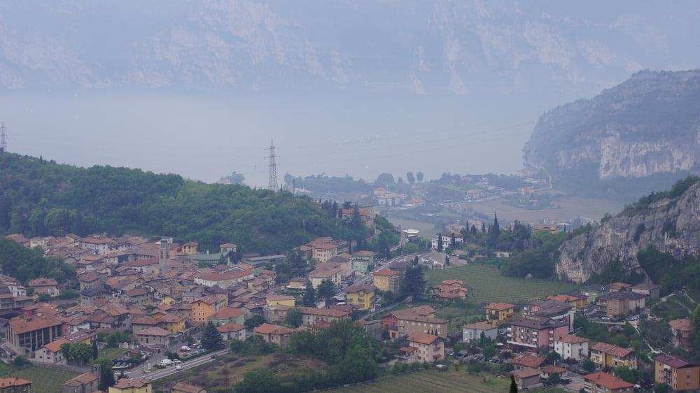
Die Auffahrt ist nicht ohne und erfordert einiges an Kondition und Kraft. Der Uphill geht auf groben Schotter und felsigen Untergrund, sowie auf festgefahrenen Erdwegen nach oben. Es sind Steigungspitzen von 15 % -18 % und im Mittel um die 8 % - 12 % zu meistern. Die Aussicht war an diesem Tag leider nicht so gut, da viel Feuchtigkeit in der Luft hing.
Der Downhill ist unspektakulär und findet auf Asphalt statt.
PS:
Der Link zu unserem "Weg von Dahoam 2011" Video auf Youtu.be zeigt noch ein paar Fotos mehr und auch einiges an Trailsequenzen. Würde mich freuen wenn, Du Dir evt. sogar das ganze Video ansiehst und es dann bewertest.
Tour gallery
Tour map and elevation profile
Minimum height 76 m
Maximum height 1025 m
More about the tour author
|
|
Pointer |
Comments

Unser Startpunkt lag in Riva del Garda.
GPS tracks
Trackpoints-
GPX / Garmin Map Source (gpx) download
-
TCX / Garmin Training Center® (tcx) download
-
CRS / Garmin Training Center® (crs) download
-
Google Earth (kml) download
-
G7ToWin (g7t) download
-
TTQV (trk) download
-
Overlay (ovl) download
-
Fugawi (txt) download
-
Kompass (DAV) Track (tk) download
-
Track data sheet (pdf) download
-
Original file of the author (gpx) download
More about the tour author
|
|
Pointer |
Add to my favorites
Remove from my favorites
Edit tags
Open track
My score
Rate