


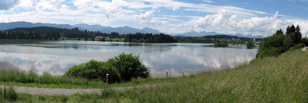
Ein gemütlicher Rundkurs im Allgäu von Kaufbeuren über Marktoberdorf, Lechbruck, Burggen, Tannenberg und Mauerstetten zurück nach Kaufbeuren mit wenigen und geringen Steigungen.
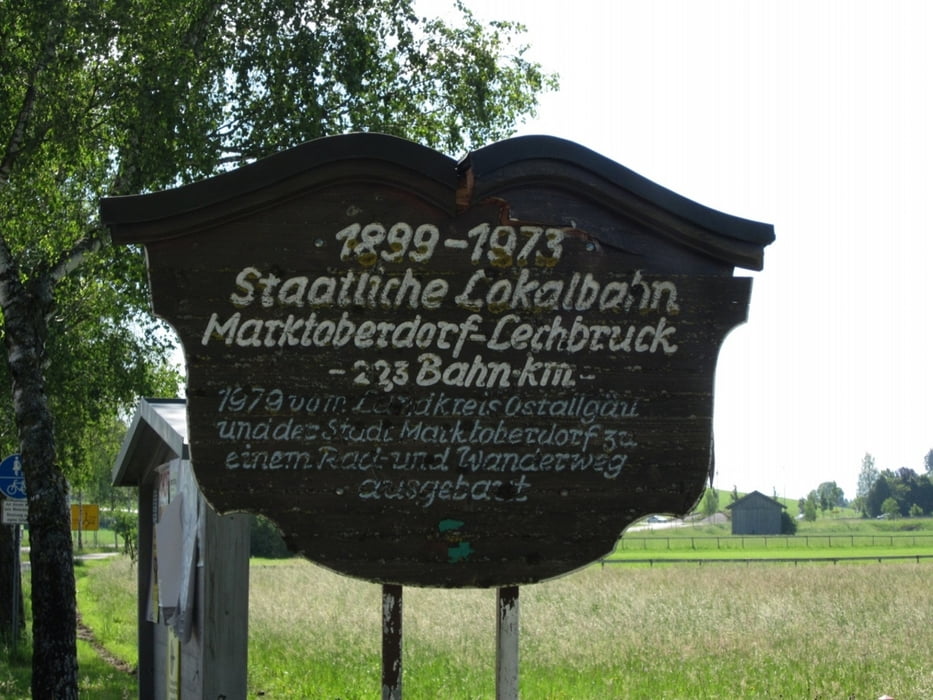
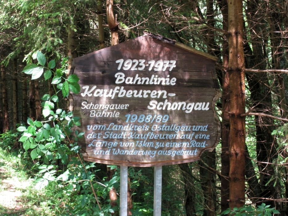
Die Tour führt zum Teil auf zwei stillgelegten Bahntrassen: 22km auf der Trasse der Bahnstrecke Marktoberdorf–Lechbruck und 13km auf der Trasse der Bahnstrecke Kaufbeuren–Schongau vom Sachsenrieder Forst nach Kaufbeuren. Zum größten Teil verläuft die Tour auf asphaltierten Wegen und Gemeindestraßen und nur teilweise auf befestigten Feld- und Waldwegen.
Teilstrecken: (ccw)
- Kaufbeuren - Lechbruck 35 km
- Lechbruck - Kaufbeuren 42 km
Weitere Radwege:
- Allgäu-Radweg: Wangen-Schongau
- WertachTour: Sonthofen-Kaufbeuren-Augsburg
Further information at
http://www.radtourist.com/dampflokrunde.htmlTour gallery
Tour map and elevation profile
Minimum height 674 m
Maximum height 869 m
More about the tour author
|
|
Alu68 |
Comments

Bei der Rundtour ist der Startpunkt variabel
Mit der Regionalbahn sind die Orte Kaufbeuren und Marktoberdorf auf der Strecke Augsburg/München - Buchloe - Füssen/Oberstdorf/Lindau erreichbar.
GPS tracks
Trackpoints-
GPX / Garmin Map Source (gpx) download
-
TCX / Garmin Training Center® (tcx) download
-
CRS / Garmin Training Center® (crs) download
-
Google Earth (kml) download
-
G7ToWin (g7t) download
-
TTQV (trk) download
-
Overlay (ovl) download
-
Fugawi (txt) download
-
Kompass (DAV) Track (tk) download
-
Track data sheet (pdf) download
-
Original file of the author (gpx) download
More about the tour author
|
|
Alu68 |
Add to my favorites
Remove from my favorites
Edit tags
Open track
My score
Rate