Login

Forgot your login?

Cookies have to be accepted!
Your browser's cookie functionality is disabled. Please enable this functionality.

Not a member yet?

Register now
Login

Available for registred users only

Log in to use this feature.

Forgot your login?

Cookies have to be accepted!
Your browser's cookie functionality is disabled. Please enable this functionality.

Not a member yet?

Register now
Filter
Categories
Advanced filters
  • Distance (km)
  • Height
Save filters Reset filter

TrackRank

QRCode

Technical data

Distance303,2 km Height1478 m Way down1522 m Duration6 days 0 h Date23.06.2011
Scores Author Landscape Fun factor Fitness Technique

Statistics

766 Views Scores 45 Downloads Average
Rate
  • Track data sheet
  • Directions
  • Downloads

Mehrtagestour:

1. Tag Bockenheim An der Weinstr. -> Bad Dürkheim -> Neustadt An der Weinstr. (mittelschwere Etappe)

2. Tag Neustadt -> Bad Bergzabern -> Schweigen-Rechtenbach (schwere Etappe; Schnitt 7km/h)

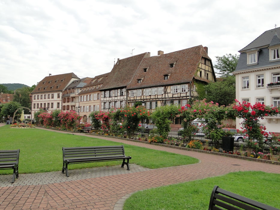
3. Tag Schweigen -> Wissembourg (F) -> Lauterburg (F) -> Wörth (leichte Tour)

4. Tag Wörth -> Speyer

5. Tag Speyer -> Worms

6. Tag Worms -> Mainz


Tour gallery

Tour map and elevation profile

  • Open Street Map
  • Google
Minimum height 75 m Maximum height 268 m Detailed view

More about the tour author

Bischemer
Member since 2009

Send private message

Comments

Wir sind mit der DB nach Bockenheim gefahren. Zurück gings von Mainz mit der S8 nach Ffm.


GPS tracks

Trackpoints
  • GPX / Garmin Map Source (gpx) download
  • TCX / Garmin Training Center® (tcx) download
  • CRS / Garmin Training Center® (crs) download
  • Google Earth (kml) download
  • G7ToWin (g7t) download
  • TTQV (trk) download
  • Overlay (ovl) download
  • Fugawi (txt) download
  • Kompass (DAV) Track (tk) download
  • Track data sheet (pdf) download
  • Original file of the author (gpx) download

More about the tour author

Bischemer
Member since 2009

Send private message
Share track
Add to my favorites
Remove from my favorites
Edit tags
My score
Rate
Track: Weinstr. Pamina- und Rheinradweg bis Mainz
Type: Trekkingbike
Distance: 303,2 km
Evaluated on:
Duration:
Day(s)
Hour(s)
Minute(s)
Score: Landscape Fun factor Fitness Technique