


Tourendatum: 29.05.2011
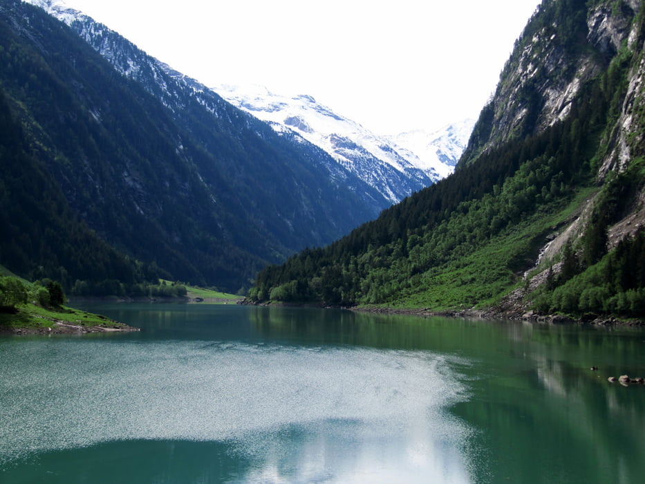
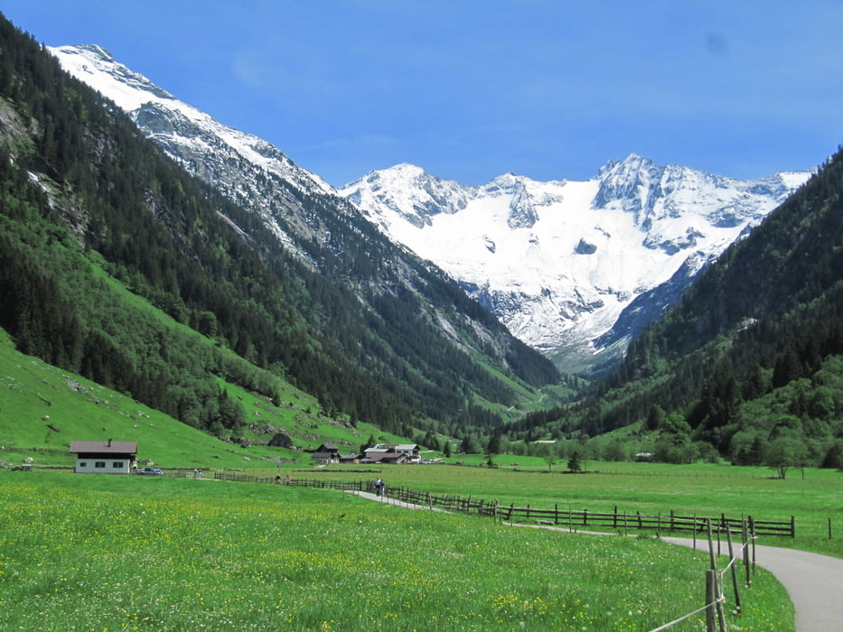
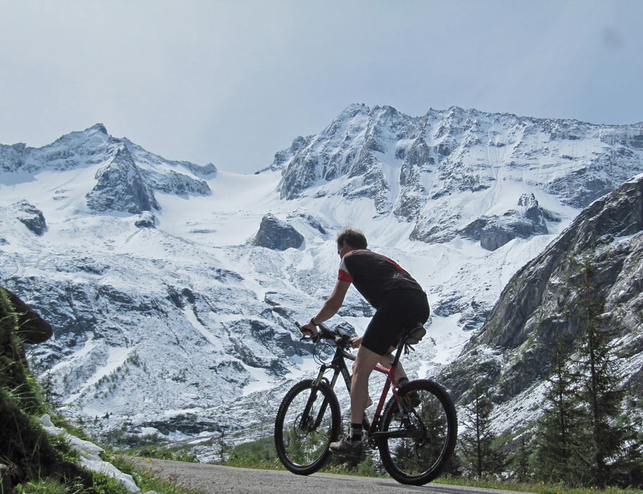
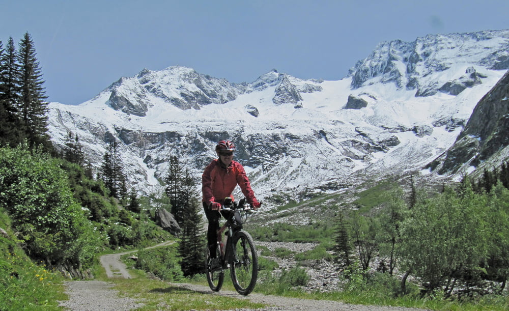
Technisch einfache Tour von Mayrhofen (ca.635m) über die Mautstrasse ins Stilluptal zum Speichersee hinauf und weiter taleinwärts, zum Schluss steil hinauf zur Talstation der Materialseilbahn (ca. 1640m) der Kasseler Hütte. Von dort besteht die Möglichkeit zu Fuß zur Kasseler Hütte (2178m, ca. 1,5h) aufzusteigen. Anfangs eher langweilig, ab dem Speichersee landschaftlich schöne und mit zunehmender Höhe alpiner werdende Biketour. Im hintersten Teil sehr schöne Hochgebirgslandschaft. Bis zum Bike-Depot sind es eigentlich nur ca. 1000 Hm, ich bin noch ein Stück zu Fuß Richtung Kasseler hütte aufgestiegen, bis mich die zunehmende Schneehöhe zur Umkehr zwang.
Einkehrmöglichkeiten: Ghs. Wasserfall, Stilluphaus, Grüne Wand-Hütte.
Fazit: Einfache Tour in schöner Hochgebirgslandschaft im hintersten Stilluptal
Picasa-Foto-Link zum Kopieren:
https://picasaweb.google.com/101543947384755168643/MTBStilluptalVonMayrhofen29052011
Tour gallery
Tour map and elevation profile
Minimum height 591 m
Maximum height 1939 m
More about the tour author
|
|
Eimy |
Comments

Inntalautobahn- Ausfahrt Zillertal- Mayrhofen-begrenzte Parkmöglichkeit beim Sportplatz oder gebührenpfl. Parkplatz bei Ahornbahn (beschildert)
GPS tracks
Trackpoints-
GPX / Garmin Map Source (gpx) download
-
TCX / Garmin Training Center® (tcx) download
-
CRS / Garmin Training Center® (crs) download
-
Google Earth (kml) download
-
G7ToWin (g7t) download
-
TTQV (trk) download
-
Overlay (ovl) download
-
Fugawi (txt) download
-
Kompass (DAV) Track (tk) download
-
Track data sheet (pdf) download
-
Original file of the author (gpx) download
More about the tour author
|
|
Eimy |
Add to my favorites
Remove from my favorites
Edit tags
Open track
My score
Rate