


Der TMV (Traversée du Massif Vosgien) ist ein Mountainbike Weg welcher beschildert ist.
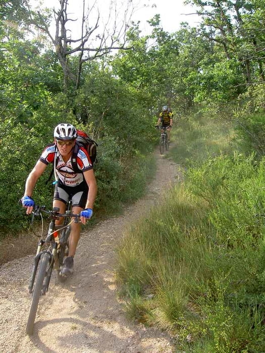
Wir haben den südlichen Teilabschnitt der MTB Route durchs Elsass die Traversée du Massif Vosgien à VTT (TMV) von Obernai nach Mulhouse in 3,5 Tagen gefahren.
Die erste Übernachtung war in Châtenois im Hôtel Beysang www.hr-beysang.com, die zweite in Col du Bonhomme in der Auberge du Col du Bonhomme die dritte und letzte in Hôtel Wolf www.hotelwolf.info.
Insgesamt ca. 220 km und 5200Hm.
1. Tag von Obernai nach Châtenois: 56 km, 1400 HM.
2. Tag von Châtenois nach Col du Bonhomme: 50 km, 1550 HM.
3. Tag von Col du Bonhomme nach Le Markstein 70km, 1900Hm.
4. Tag von Le Markstein bis zum Bahnhof Mulhouse 45km, 450 Hm.
Die restlichen Kilometer sind vom Ziel- Bahnhof in Selestat bis zum Auto in Obernai entstanden.
ACHTUNG: Wir haben uns auf Grund der schlechten Beschilderung trotz Original Road Book verfahren.
Die Hotel sind einfach und ensprechen nicht dem deutschen Standard. Das Essen war jedoch immer gut.
Further information at
http://www.tmv-alsace-vtt.com/index.htmlTour gallery
Tour map and elevation profile
Minimum height 164 m
Maximum height 1347 m
More about the tour author

|
winklem |
Comments

Start in Obernai und mit dem Zug von Mulhouse nach Sélestat zurück und mit den Bike wieder zum Auto in Obernai. Zugfahrpreis war pro Person mit Bike 6 EUR (2007).
GPS tracks
Trackpoints-
GPX / Garmin Map Source (gpx) download
-
TCX / Garmin Training Center® (tcx) download
-
CRS / Garmin Training Center® (crs) download
-
Google Earth (kml) download
-
G7ToWin (g7t) download
-
TTQV (trk) download
-
Overlay (ovl) download
-
Fugawi (txt) download
-
Kompass (DAV) Track (tk) download
-
Track data sheet (pdf) download
-
Original file of the author (g7t) download
More about the tour author
|
|
winklem |
Add to my favorites
Remove from my favorites
Edit tags
Open track
My score
Rate