


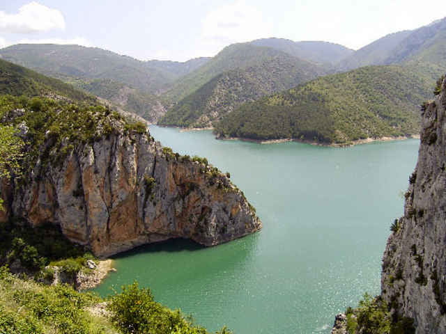
Im Juni 2007 habe ich eine Radwanderung durch den Norden Aragóns unternommen. Die Tour startet und endet im Vall de Boí, das zu Katalonien gehört. Sie führt über meist gut ausgebaute Nationalstraßen an vielen türkisblauen Stauseen vorbei. Es sind auch ein paar Pässe zu bezwingen, und eine tiefe Schlucht namens Congosto de Ventamillo ist auch dabei.
Von Benasque und Barruera aus kann man zu verschiedenen Fuß-Wandertouren aufbrechen. Entsprechende Tracks habe ich in der Rubrik Wandern ebenfalls bereitgestellt. Die Tour ließe sich aber auch gut mit einer Tour zum nicht weit entfernten Ordesa-Park kombinieren.
Mehr steht auf meiner Web-Seite. (s.u.)
Further information at
http://www.radwahn.deTour gallery
Tour map and elevation profile
Minimum height 315 m
Maximum height 1473 m
More about the tour author
|
|
Thilo |
Comments

Ich bin mit dem Rad im Auto nach Barruera im Vall de Boí gefahren. Das Auto habe ich dann auf dem Campingplatz Boneta stehen gelassen und bin mit dem Rad weitergefahren.
GPS tracks
Trackpoints-
GPX / Garmin Map Source (gpx) download
-
TCX / Garmin Training Center® (tcx) download
-
CRS / Garmin Training Center® (crs) download
-
Google Earth (kml) download
-
G7ToWin (g7t) download
-
TTQV (trk) download
-
Overlay (ovl) download
-
Fugawi (txt) download
-
Kompass (DAV) Track (tk) download
-
Track data sheet (pdf) download
-
Original file of the author (gpx) download
More about the tour author
|
|
Thilo |
Add to my favorites
Remove from my favorites
Edit tags
Open track
My score
Rate