


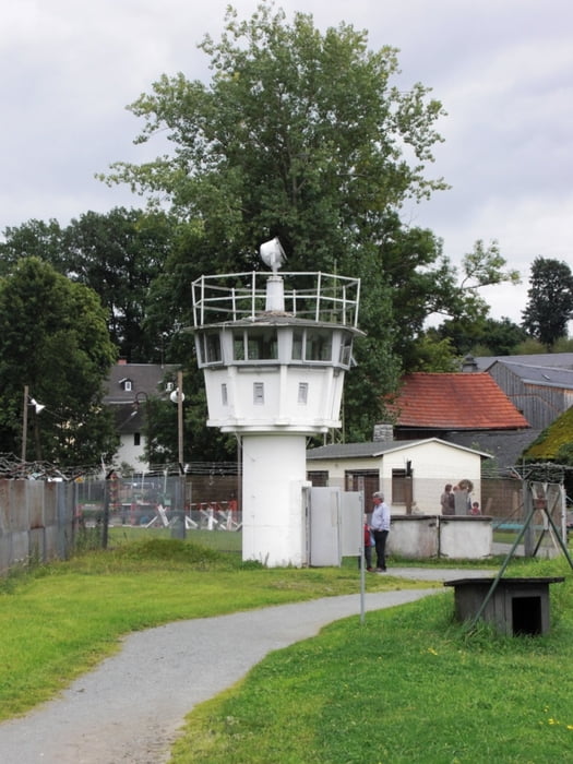
Es geht entlang an der ehemeligen innerdeutschen Grenze! Das ist Geschichte pur... Unterwegs bestht die Möglichkeit immer wieder die Grenze zu verlassen um echt Strecke zu machen. Es geht entlang auf den ehemaligen Kolonnenwegen die mit ihren "Lochbetonplatten" nicht immer ideal zum radln sind...
Tour gallery


Tour map and elevation profile
Minimum height 232 m
Maximum height 737 m
More about the tour author

|
Rolofilo |
Comments

Die Anfahrt erfolgt von Süden kommend über die A9 und die A93 in Richtung Regnitzlosau. Von dort weiter nach Prex und HInterprex. Man kann dann (mit etwas Glück) ein Schild Dreiländereck sehen.
Dort startet die Reise!
Vorsicht, bis zum Startpunkt holt man sich meist nasse Füße...
GPS tracks
Trackpoints-
GPX / Garmin Map Source (gpx) download
-
TCX / Garmin Training Center® (tcx) download
-
CRS / Garmin Training Center® (crs) download
-
Google Earth (kml) download
-
G7ToWin (g7t) download
-
TTQV (trk) download
-
Overlay (ovl) download
-
Fugawi (txt) download
-
Kompass (DAV) Track (tk) download
-
Track data sheet (pdf) download
-
Original file of the author (gpx) download
More about the tour author
|
|
Rolofilo |
Add to my favorites
Remove from my favorites
Edit tags
Open track
My score
Rate