


Start vom Campingplatz Sas Dlacia am Fuße des Valparola Pass. Abfahrt nach Stern (La Villa) und Auffahrt über Corvara zum Grödner Joch. Weiterfahrt zum Sella Joch und Pordoi. Abfahrt durch Arabba nach Pieve di Livinallongo. Von dort nach Andraz. Ca. 1km nach Andraz an Kreuzung rechts abbiegen und über Villagrande und Pian in Richtung Selva die Cadore. Nach einer Brücke links Abzweig zum Passo Giau. Von dort Abfahrt nach Pocol und Abzweig zum Falzaergo und zum Schluß über den Valparola zum Ziel/Start.
Einkehrmöglichkeiten unterwegs gibt es viele. Sehr gut gegessen haben wir im Restaurant Belvedere zur Auffahrt nach Villagrande.
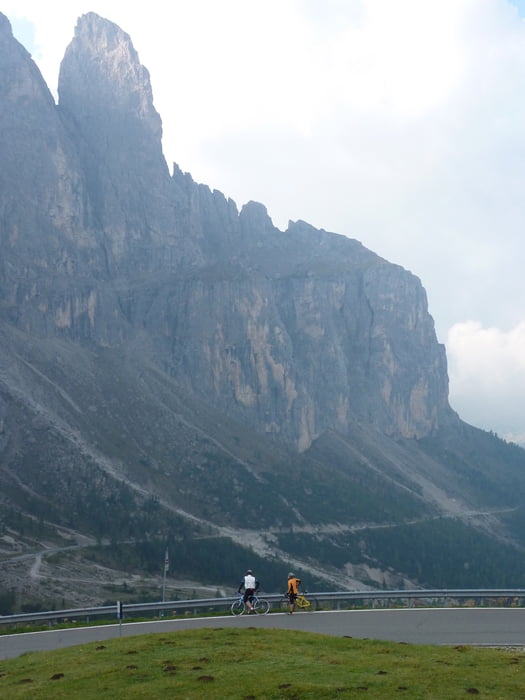
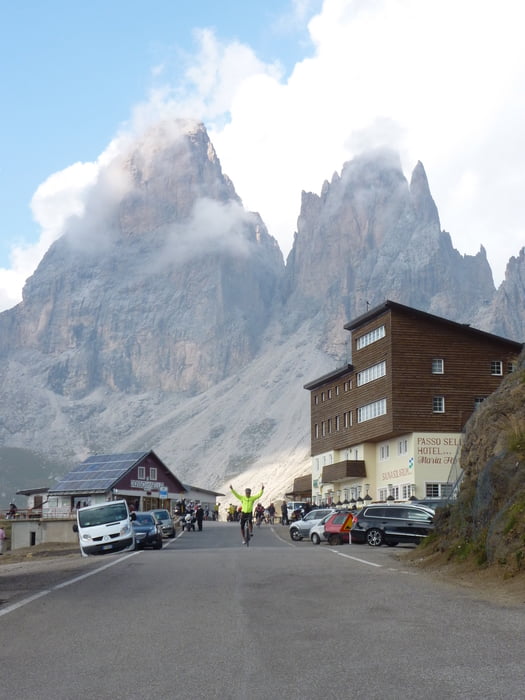
Da die Aussicht überall phantastisch ist, lohnt es sich, viele Fotopausen zu machen und mehr Zeit einzuplanen.
Den Passo Giau kann man wenn man ca. 1000 Höhenmeter sparen will, auslassen und fährt nach Andraz in Richtung Falzarego und Valparola zum Ziel.
Leider weicht die Aufzeichnung vom Straßenverlauf des öfteren ab. Eine Erklärung wäre evtl. der begrenzte Satelitenempfang durch die hohen Berge?
Tour gallery


Tour map and elevation profile
Minimum height 1444 m
Maximum height 2308 m
More about the tour author
|
|
CF2008 |
Comments

GPS tracks
Trackpoints-
GPX / Garmin Map Source (gpx) download
-
TCX / Garmin Training Center® (tcx) download
-
CRS / Garmin Training Center® (crs) download
-
Google Earth (kml) download
-
G7ToWin (g7t) download
-
TTQV (trk) download
-
Overlay (ovl) download
-
Fugawi (txt) download
-
Kompass (DAV) Track (tk) download
-
Track data sheet (pdf) download
-
Original file of the author (gpx) download
More about the tour author
|
|
CF2008 |
Add to my favorites
Remove from my favorites
Edit tags
Open track
My score
Rate