

Alleine der Name reitz schon - mal schaun wie er ausschaut der schöne Mann.
Weil kurz und technisch einfach ist die Tour perfekt geeignet als Familienwanderung. Trotz der Einfachheit, ist der Weg abwechslungsreich und wird für die Kleinen nicht langweilig.
Der erste Teil führ einfach auf Almwegen bergauf, wer will kann auch auf Trampelpfaden quer über Almwiesen gehen. Der obere Teil führt, anfangs weglos dann auf Pfaden steil bergauf, ist aber trotzdem recht einfach.
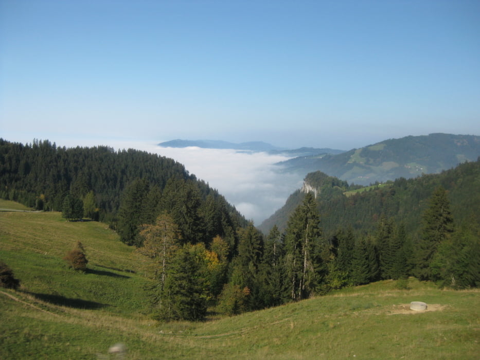
Die Aussicht vom Gipfel ist genial. Als wir oben waren lag Nebel über dem Bodensse und dem Rheintal, wir genossen die Sonne.
Nach der Tour kann man noch eine Erfrischung im Schiheim genießen.
Tour map and elevation profile
Minimum height 1047 m
Maximum height 1394 m
More about the tour author

|
Christi0012 |
Comments

Von der Autobahn bei Hohenems abfahren und zuerst der Beschilderung zum Krankenhaus dann den roten Wegweisern nach "Schuttannen" folgen. Nach Emsreute wird die Straße steil und der Asphalt endet. Auf der Schotterstraße weiter bis Schuttannen. Man kann, am Restaurant vorbei, noch etwas weiter fahren und erst kurz oberhalb beim Schiheim parken.
GPS tracks
Trackpoints-
GPX / Garmin Map Source (gpx) download
-
TCX / Garmin Training Center® (tcx) download
-
CRS / Garmin Training Center® (crs) download
-
Google Earth (kml) download
-
G7ToWin (g7t) download
-
TTQV (trk) download
-
Overlay (ovl) download
-
Fugawi (txt) download
-
Kompass (DAV) Track (tk) download
-
Track data sheet (pdf) download
-
Original file of the author (gpx) download
More about the tour author
|
|
Christi0012 |
Add to my favorites
Remove from my favorites
Edit tags
Open track
My score
Rate