


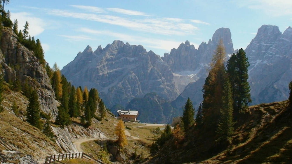
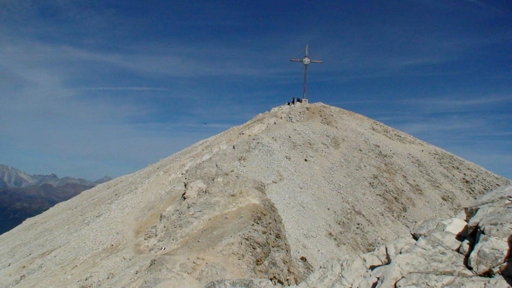
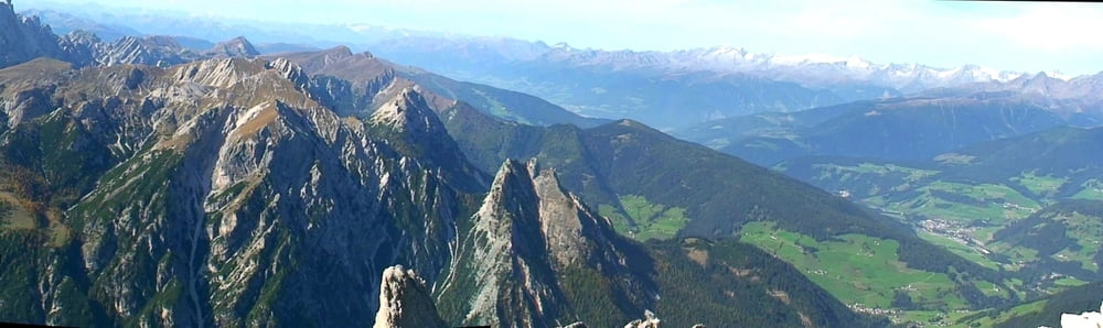
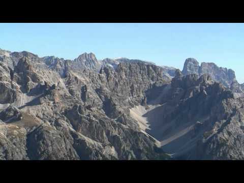
Vom Parkplatz ein Stück an der Straße entlang (ca. 1,6km), dann rechts ab (Weg 18) durch das Knappenfuß- Tal stetig bergan zur Plätzwiese. Hier über die Dürrenstein- Alpe auf alpinem Weg (40) zum Dürrenstein 2.839m. Eine phantastische Aussicht kann man hier genießen!
Abstieg auf gleichem Weg zurück und weiter zur Dürrenstein- Hütte 2.040m. Hier sieht man noch Überreste der Befestigungen der Front aus dem I. Weltkrieg.
Abstieg durch das Seeland- Tal zur Straße und Parkplatz.
Tour gallery

Tour map and elevation profile
Minimum height 1463 m
Maximum height 2802 m
More about the tour author
|
|
heinz-57 |
Comments

Google Earth: N 46.621411° / E 12.211206°
Von Toblach Richtung Misurina, nach dem Dürrensee rechts ab nach Schluderbach. Ca. 300m hinter dem Ort Parkplatz.
GPS tracks
Trackpoints-
GPX / Garmin Map Source (gpx) download
-
TCX / Garmin Training Center® (tcx) download
-
CRS / Garmin Training Center® (crs) download
-
Google Earth (kml) download
-
G7ToWin (g7t) download
-
TTQV (trk) download
-
Overlay (ovl) download
-
Fugawi (txt) download
-
Kompass (DAV) Track (tk) download
-
Track data sheet (pdf) download
-
Original file of the author (gpx) download
More about the tour author
|
|
heinz-57 |
Add to my favorites
Remove from my favorites
Edit tags
Open track
My score
Rate