Login

Forgotten password?

Cookies have to be accepted!
Your browser's cookie functionality is disabled. Please enable this functionality.

Not a member yet?

Register now
Login

Available for registred users only

Log in to use this feature.

Forgotten password?

Cookies have to be accepted!
Your browser's cookie functionality is disabled. Please enable this functionality.

Not a member yet?

Register now
Filter
Categories
Advanced filters
  • Distance (km)
  • Height
Save filters Reset filter

TrackRank

QRCode

Technical data

Distance18,3 km Height756 m Way down751 m Duration1 day 0 h Date03.11.2011
Scores Author Landscape Fun factor Fitness Technique

Statistics

527 Views Scores 89 Downloads Average
Rate
  • Track data sheet
  • Directions
  • Downloads
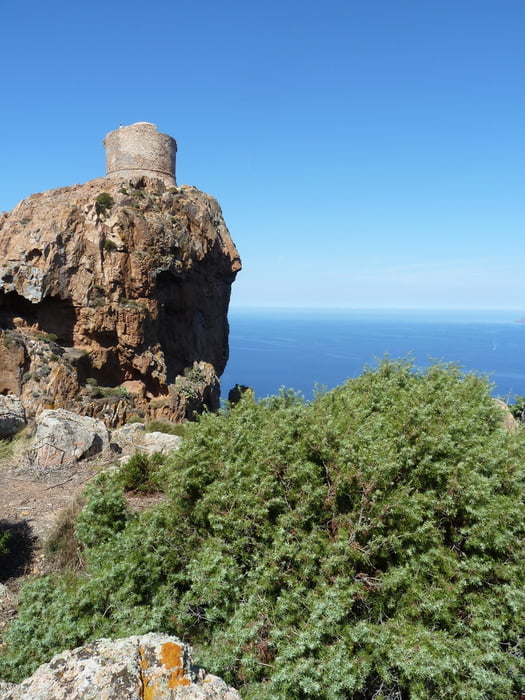
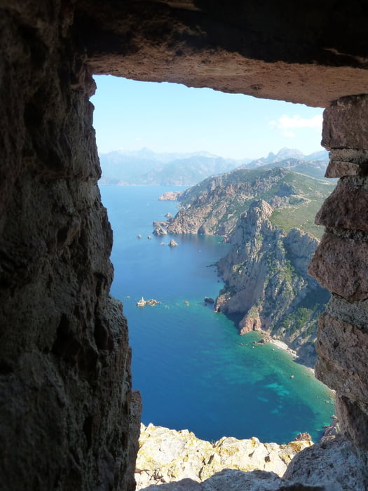
Sehr schöne, unschwierige Wanderung mit wunderschönen Ausblicken. Vorsicht, wenig Schatten!

Tour gallery

Tour map and elevation profile

  • Open Street Map
  • Google
Minimum height 12 m Maximum height 336 m Detailed view

More about the tour author

B_Kalli
Member since 2011

Send private message

Comments

Von Piana Richtung Bucht von Arone, nach ca. 6km bei einem Parkplatz in einer Kurve befindet sich der Ausgangspunkt. Es befindet sich dort auch ein Restaurant.

GPS tracks

Trackpoints
  • GPX / Garmin Map Source (gpx) download
  • TCX / Garmin Training Center® (tcx) download
  • CRS / Garmin Training Center® (crs) download
  • Google Earth (kml) download
  • G7ToWin (g7t) download
  • TTQV (trk) download
  • Overlay (ovl) download
  • Fugawi (txt) download
  • Kompass (DAV) Track (tk) download
  • Track data sheet (pdf) download
  • Original file of the author (gpx) download

More about the tour author

B_Kalli
Member since 2011

Send private message
Share track
Add to my favorites
Remove from my favorites
Edit tags
My score
Rate
Track: Capu Rosso - Korsika
Type: Hiking
Distance: 18,3 km
Evaluated on:
Duration:
Day(s)
Hour(s)
Minute(s)
Score: Landscape Fun factor Fitness Technique