Login

Forgotten password?

Cookies have to be accepted!
Your browser's cookie functionality is disabled. Please enable this functionality.

Not a member yet?

Register now
Login

Available for registred users only

Log in to use this feature.

Forgotten password?

Cookies have to be accepted!
Your browser's cookie functionality is disabled. Please enable this functionality.

Not a member yet?

Register now
Filter
Categories
Advanced filters
  • Distance (km)
  • Height
Save filters Reset filter

TrackRank

QRCode

Technical data

Distance23,3 km Height998 m Way down993 m Duration02:11 h:m Date21.07.2007
Scores Author Landscape Fun factor Fitness Technique

Statistics

1327 Views Scores 160 Downloads Average
Rate
  • Track data sheet
  • Directions
  • Downloads
Sehr steiler Anstieg ueber Raedermacher - Ammenegg - Rodelbahn. Anschliessend gemuetlich ueber Boedele, Alpe Hochaelpele, Gschwend, Kehlegg, Schauner zurueck nach Dornbirn. ca. 995 Hoehenmeter

Further information at

http://klauserg.dyndns.org/1701_11_1_index_sport_bike_tour11.php

Tour gallery

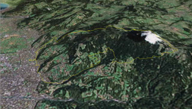
Tour map and elevation profile

  • Open Street Map
  • Google
Minimum height 429 m Maximum height 1289 m Detailed view

More about the tour author

klauserg
Member since 2007

Send private message

Comments

Abendrunde auf das Boedle

GPS tracks

Trackpoints
  • GPX / Garmin Map Source (gpx) download
  • TCX / Garmin Training Center® (tcx) download
  • CRS / Garmin Training Center® (crs) download
  • Google Earth (kml) download
  • G7ToWin (g7t) download
  • TTQV (trk) download
  • Overlay (ovl) download
  • Fugawi (txt) download
  • Kompass (DAV) Track (tk) download
  • Track data sheet (pdf) download
  • Original file of the author (gpx) download

More about the tour author

klauserg
Member since 2007

Send private message
Share track
Add to my favorites
Remove from my favorites
Edit tags
My score
Rate
Track: Dornbirn Boedele
Type: Mountain bike
Distance: 23,3 km
Evaluated on:
Duration:
Day(s)
Hour(s)
Minute(s)
Score: Landscape Fun factor Fitness Technique