


Startpunkt der Tour ML Fuerteventura Playa de Esquinzo. Nach 8 km ein schöner Aussichtspunkt zur Ostküste,
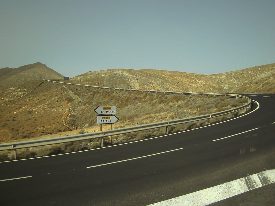
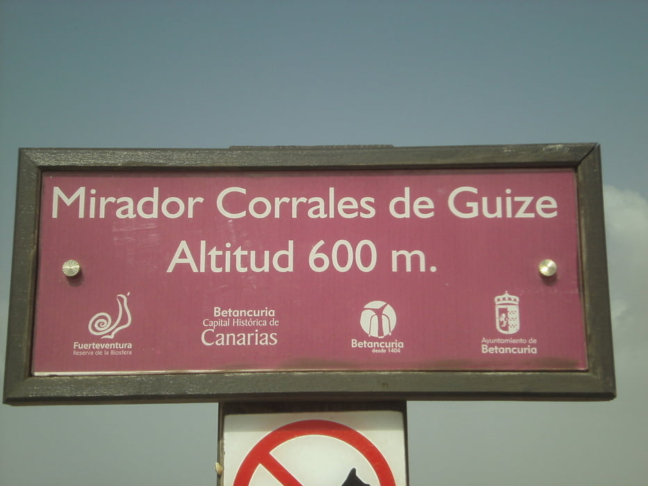
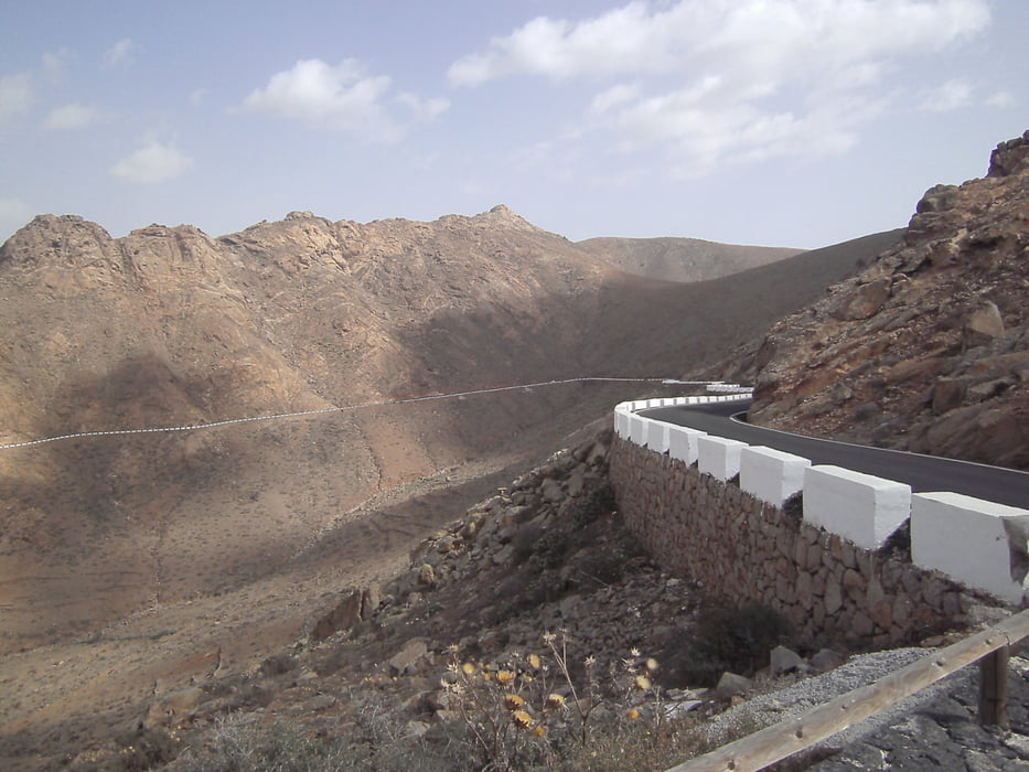
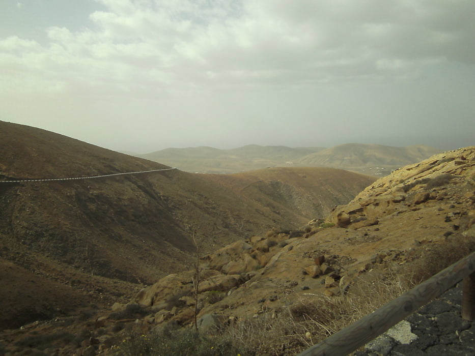
nach ca.17 km ist man in Costa Calma. Außerhalb von Costa Calma im Kreisverkehr links Richtung La Pared mit schönen Ausblicken zur Westküste. Ab La Pared beginnt die Steigung zum Morro Colorado. Kurz vor der Passhöhe rechts abbiegen Richtung Cardon (sehr steile Abfahrt!). Weiter Richtung Antigua über Tuineje. In Antigua links abbiegen nach Mirador de Morro Velosa. Somit ist der höchste Punkt der Tour (600m) erreicht und man kann einen herrlichen Rundumblick auf die Insel genießen. In der Folge warten noch drei weitere nennenswerte Anstiege über Pajara bis man wieder zum Morro Colorado kommt. Von dort geht es wieder zurück zum Ausgangspunkt.
nach ca.17 km ist man in Costa Calma. Außerhalb von Costa Calma im Kreisverkehr links Richtung La Pared mit schönen Ausblicken zur Westküste. Ab La Pared beginnt die Steigung zum Morro Colorado. Kurz vor der Passhöhe rechts abbiegen Richtung Cardon (sehr steile Abfahrt!). Weiter Richtung Antigua über Tuineje. In Antigua links abbiegen nach Mirador de Morro Velosa. Somit ist der höchste Punkt der Tour (600m) erreicht und man kann einen herrlichen Rundumblick auf die Insel genießen. In der Folge warten noch drei weitere nennenswerte Anstiege über Pajara bis man wieder zum Morro Colorado kommt. Von dort geht es wieder zurück zum Ausgangspunkt.
Tour gallery
Tour map and elevation profile
Minimum height 15 m
Maximum height 604 m
More about the tour author
|
|
max64 |
Comments

GPS tracks
Trackpoints-
GPX / Garmin Map Source (gpx) download
-
TCX / Garmin Training Center® (tcx) download
-
CRS / Garmin Training Center® (crs) download
-
Google Earth (kml) download
-
G7ToWin (g7t) download
-
TTQV (trk) download
-
Overlay (ovl) download
-
Fugawi (txt) download
-
Kompass (DAV) Track (tk) download
-
Track data sheet (pdf) download
-
Original file of the author (gpx) download
More about the tour author
|
|
max64 |
Add to my favorites
Remove from my favorites
Edit tags
Open track
My score
Rate