


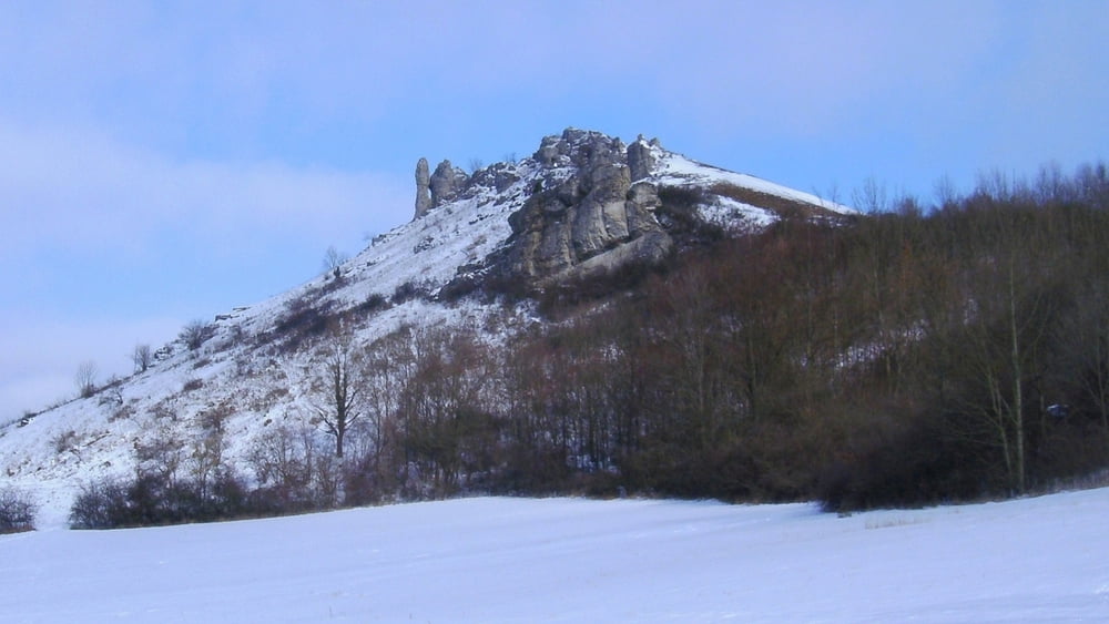
In Schlaifhausen zur Kirche, links ab und bald nach rechts aufwärts zu Parkplatz. Geradeaus fast eben dahin, kurz leicht aufwärts zu Aussichtspunkt mit Kreuz oberhalb Kirchehrenbach: wir genießen den Ausblick in die Fränkische Schweiz, über Kirchehrenbach hinweg zur "Rettener Kanzel" und nach links bis Forchheim.
Kurz zurück,an Info- Tafeln nach rechts abwärts und an Schranke links zurück. An Querweg rechts, kurz abwärts und links ziemlich eben dahin zurück nach Schlaifhausen.
Tour gallery


Tour map and elevation profile
Minimum height 360 m
Maximum height 487 m
More about the tour author
|
|
heinz-57 |
Comments

Google Earth: 49.707278° N / 11.154138° E
Von Forchheim kommend auf B470 bis Reuth, rechts ab, nach Bahnüberführung links und kurz danach rechts aufwärts durch Wiesenthau nach Schlaifhausen.
GPS tracks
Trackpoints-
GPX / Garmin Map Source (gpx) download
-
TCX / Garmin Training Center® (tcx) download
-
CRS / Garmin Training Center® (crs) download
-
Google Earth (kml) download
-
G7ToWin (g7t) download
-
TTQV (trk) download
-
Overlay (ovl) download
-
Fugawi (txt) download
-
Kompass (DAV) Track (tk) download
-
Track data sheet (pdf) download
-
Original file of the author (gpx) download
More about the tour author
|
|
heinz-57 |
Add to my favorites
Remove from my favorites
Edit tags
Open track
My score
Rate