


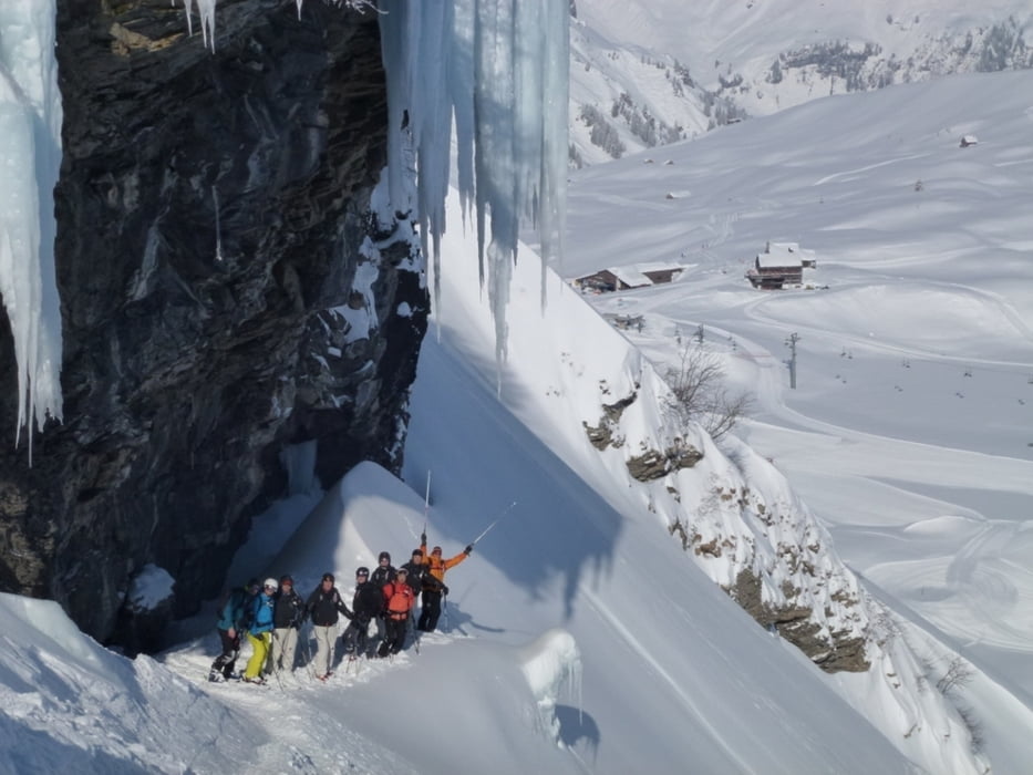
Es empfiehlt sich die Touren unbedingt mit einen Bergführer zu machen. Sehr gutes Offpist Skifahren, Lawinenausbildung, Trittsicherheit und Spuranlage ist Voraussetzung. (siehe hierzu weiterführende Links oder www.berg-fuehrer.ch)
Unter Ausnutzen der Liftanlagen und kleinere Aufstiege, unterwegs im erweiterten Skigebiet von Engelberg. Auf der Nordabfahrt ist im unteren Teil Ortskenntnis gefragt um den Ausstieg und die letzten guten Hänge zu finden. Man gelangt an die Talstation der Fürenalp. Von hier geht ein Ski Bus zurück nach Engelberg.
Rückfahrt mit dem Bus nach Einkehr in der Gaststätte kurz nach (ca. 500m) der Fürenalp. Auch hier besteht eine Bushaltestelle.
Further information at
http://www.berg-fuehrer.chTour gallery
Tour map and elevation profile
Minimum height 850 m
Maximum height 3048 m
More about the tour author
|
|
prokulus |
Comments

Autobahn über Luzern nach Engelberg. Ausgangspunkt Bergbahn Titlis Talstation
GPS tracks
Trackpoints-
GPX / Garmin Map Source (gpx) download
-
TCX / Garmin Training Center® (tcx) download
-
CRS / Garmin Training Center® (crs) download
-
Google Earth (kml) download
-
G7ToWin (g7t) download
-
TTQV (trk) download
-
Overlay (ovl) download
-
Fugawi (txt) download
-
Kompass (DAV) Track (tk) download
-
Track data sheet (pdf) download
-
Original file of the author (gpx) download
More about the tour author
|
|
prokulus |
Add to my favorites
Remove from my favorites
Edit tags
Open track
My score
Rate