


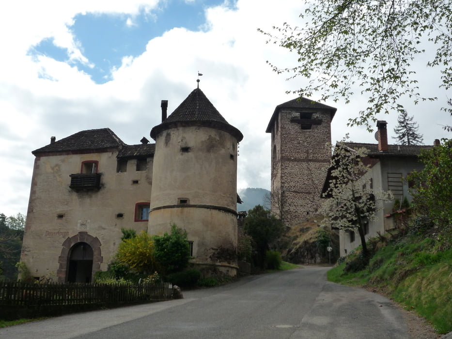
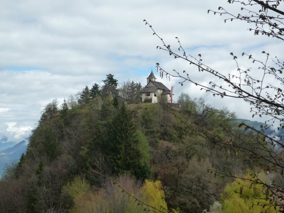
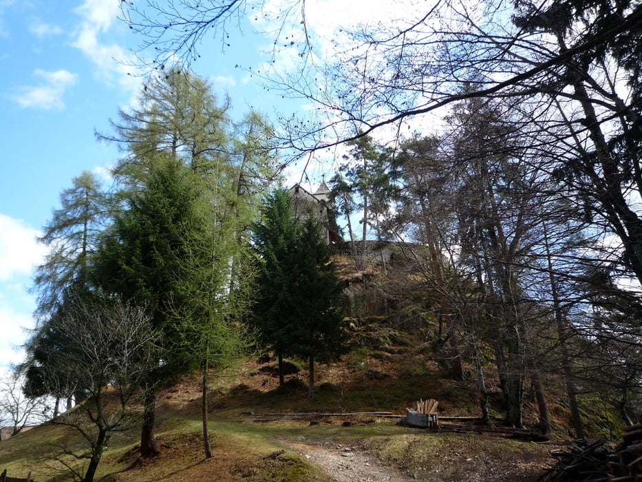
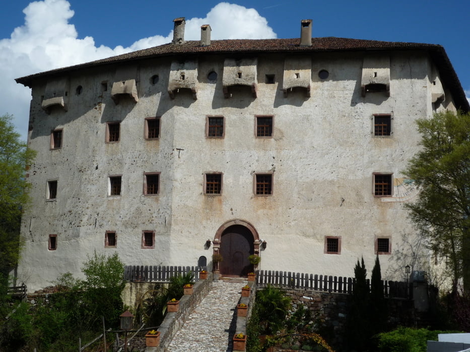
Vom Tourismusbüro Nals ausgehend biegt man in die Goldgasse ein. Links neben der Bäckerei beginnt der Nachtigallenweg. Vorbei am Schloss Payersberg wandert man weiter nach Obersirmian. Von dort genießen Sie einen wunderbaren Panoramablick auf das Etschtal und die Dolomiten. Am Gasthaus Apollonia angekommen, sieht man auf einem bewaldeten Hügel die kleine St.-Apollonia-Kirche aus dem 13. Jh. In unmittelbarer Nähe des Parkplatzes steigt man einen Hohlweg folgend, bergauf in Richtung St. Jakob. An der St.-Jakob-Kirche (Fresken, 12. Jh.) vorbei, wandert man in Richtung Grissian und anschließend nach Prissian zum Schloß Katzenzungen. Dort befindet sich die größte und älteste Weinrebe Europas. Von hier aus folgt man dem Weg Nr. 2 vorbei an der Ruine Pfeffersburg zurück nach Nals.
Track bereinigt, gelaufen 4/2012!
Further information at
https://www.suedtirol.com/meran-und-umgebung/nalsTour gallery
Tour map and elevation profile
Minimum height 272 m
Maximum height 980 m
More about the tour author
|
|
FLU |
Comments

GPS tracks
Trackpoints-
GPX / Garmin Map Source (gpx) download
-
TCX / Garmin Training Center® (tcx) download
-
CRS / Garmin Training Center® (crs) download
-
Google Earth (kml) download
-
G7ToWin (g7t) download
-
TTQV (trk) download
-
Overlay (ovl) download
-
Fugawi (txt) download
-
Kompass (DAV) Track (tk) download
-
Track data sheet (pdf) download
-
Original file of the author (gpx) download
More about the tour author
|
|
FLU |
Add to my favorites
Remove from my favorites
Edit tags
Open track
My score
Rate