Login

Login oublié ?

Cookies have to be accepted!
Your browser's cookie functionality is disabled. Please enable this functionality.

Not a member yet?

Register now
Login

Available for registred users only

Log in to use this feature.

Login oublié ?

Cookies have to be accepted!
Your browser's cookie functionality is disabled. Please enable this functionality.

Not a member yet?

Register now
Filter
Catégories
Advanced filters
  • Longueur (km)
  • Altimètre
Enregistrer le filtre Reset filter

TrackRank

QRCode

Technical data

Longueur82,6 km Altimètre140 m Way down140 m Durée03:30 h:m Date31.08.2014
Evaluations Author Paysage Aspect amusement Condition Technique

Statistiques

596 Vues Evaluations 52 Téléchargements Moyenne
Rate
  • Feuille de tours
  • Arrivée
  • Téléchargements

Startpunkt: Ist ein Parkplatz von einem Campingplatz an der D62.

Von hier aus fahren wir direkt Richtung Süden ans Meer. Dann weiter Richtung Westen nach La Grande Motte. Die 70er Jahre Architektur ist sehenswert und gar nicht so über wie man annehmen könnte.

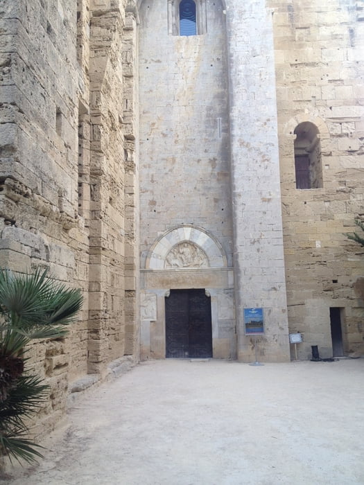
Von hier geht es zuerst entlang der Küste dann später entlang des Canal du Rhone a Sete nach Camon und weiter über Palavas les Flots zur Cathedrale Saint-Pierre-et-Saint Paul de Maguelone. Als ich dort war, war diese leider noch geschlossen.

Um weiter zu fahren, sollte man ganz im Westen um die halbinsel rum. Ich musste mein Rad über zwei Zäune haben was etwas umständlich war. Dann fährt man über den Etang de l Amel nach Villeneuve-les-Maguelone.

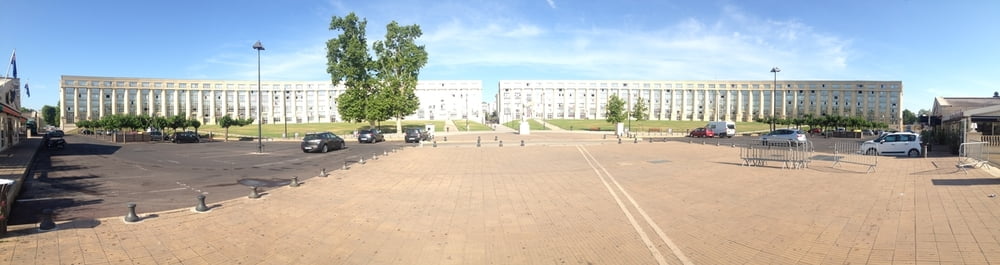
Von dort geht es nach Montepellier wo ich zum Esplanade de lEurope gefahren bin.

Aber es lohnt sich sicher einen Abstecher in die Altstadt zu unternehmen. Ich hatte dafür leider keine Zeit und sofort weiter und über Mauguio und Lunel zurück zum Ausgangspunkt.

Galerie du tour

Carte du tour et altitude

  • Open Street Map
  • Google
Minimum height -1 m Maximum height 49 m Vue de détail

More about the tour author

Cycling666
Member since 2010

Send private message

Commentaires

Ausgangspunkt ist ein Parkplatz for dem Camping La Petite Carmague. Dieser ist am Besten mit dem Auto zu erreichen.


Tracks GPS

Trackpoints
  • GPX / Garmin Map Source (gpx) download
  • TCX / Garmin Training Center® (tcx) download
  • CRS / Garmin Training Center® (crs) download
  • Google Earth (kml) download
  • G7ToWin (g7t) download
  • TTQV (trk) download
  • Overlay (ovl) download
  • Fugawi (txt) download
  • Kompass (DAV) Track (tk) download
  • Feuille de tours (pdf) download
  • Original file of the author (gpx) download

More about the tour author

Cycling666
Member since 2010

Send private message
Share track
Add to my favorites
Remove from my favorites
Edit tags
My score
Rate
Tour: La Grau-de-Roi, La Grande Motte, Montpellier und zurück
Cat.: Mountainbike
Longueur: 82,6 km
Evaluated on:
Durée:
Day(s)
Hour(s)
Minute(s)
Evaluation: Paysage Aspect amusement Condition Technique