Login

Login oublié ?

Cookies have to be accepted!
Your browser's cookie functionality is disabled. Please enable this functionality.

Not a member yet?

Register now
Login

Available for registred users only

Log in to use this feature.

Login oublié ?

Cookies have to be accepted!
Your browser's cookie functionality is disabled. Please enable this functionality.

Not a member yet?

Register now
Filter
Catégories
Advanced filters
  • Longueur (km)
  • Altimètre
Enregistrer le filtre Reset filter

TrackRank

QRCode

Technical data

Longueur15,1 km Altimètre310 m Way down0 m Durée04:00 h:m Date02.05.2010
Evaluations Author Paysage Aspect amusement Condition Technique

Statistiques

851 Vues 1 Evaluation 127 Téléchargements 5.00 Moyenne
Rate
  • Feuille de tours
  • Arrivée
  • Téléchargements

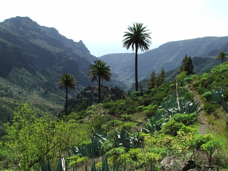
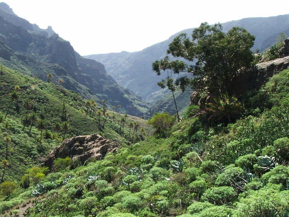
Wegverlauf: Degollada de Peraza - Ermita Virgen de las Nieves - Roque de Agando - Benchijigua - Barranco de Benchijigua - Pastrana - Barranco de Santiago - Playa de Santiago

1.350 Höhenmeter Abstieg

Galerie du tour

Carte du tour et altitude

  • Open Street Map
  • Google
Minimum height 99999 m Maximum height -99999 m Vue de détail

More about the tour author

lothardomnik
Member since 2009

Send private message

Commentaires

Startpunkt: Degollada de Peraza (Buslinien 1 und 3 von San Sebastián)
Endpunkt: Playa de Santiago (Buslinie 3 zum Startpunkt der Wanderung und nach San Sebastián)

Tracks GPS

Trackpoints
  • GPX / Garmin Map Source (gpx) download
  • TCX / Garmin Training Center® (tcx) download
  • CRS / Garmin Training Center® (crs) download
  • Google Earth (kml) download
  • G7ToWin (g7t) download
  • TTQV (trk) download
  • Overlay (ovl) download
  • Fugawi (txt) download
  • Kompass (DAV) Track (tk) download
  • Feuille de tours (pdf) download
  • Original file of the author (gpx) download

More about the tour author

lothardomnik
Member since 2009

Send private message
Share track
Add to my favorites
Remove from my favorites
Edit tags
My score
Rate
Tour: La Gomera: Barranco de Benchijigua und Barranco de Santiago
Cat.: Tour en montagne
Longueur: 15,1 km
Evaluated on:
Durée:
Day(s)
Hour(s)
Minute(s)
Evaluation: Paysage Aspect amusement Condition Technique